We told ourselves we were free because we were free.
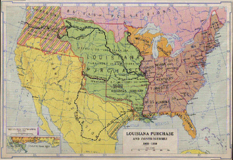
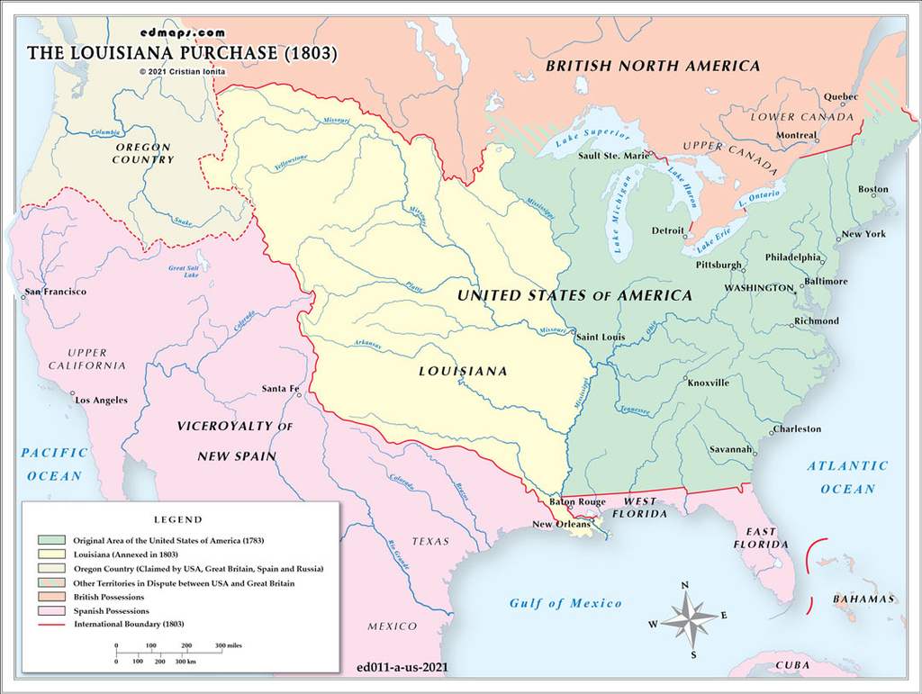
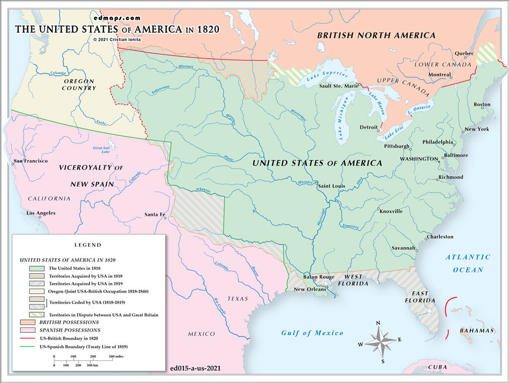
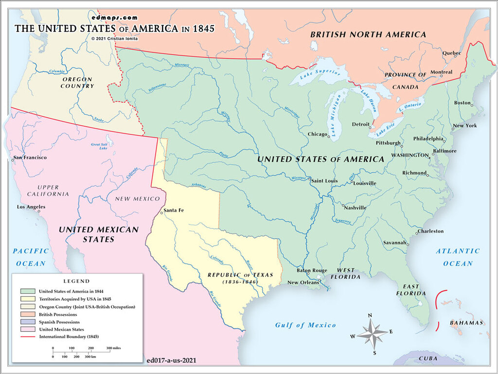
We told ourselves the land was ours because we had the maps to prove it.
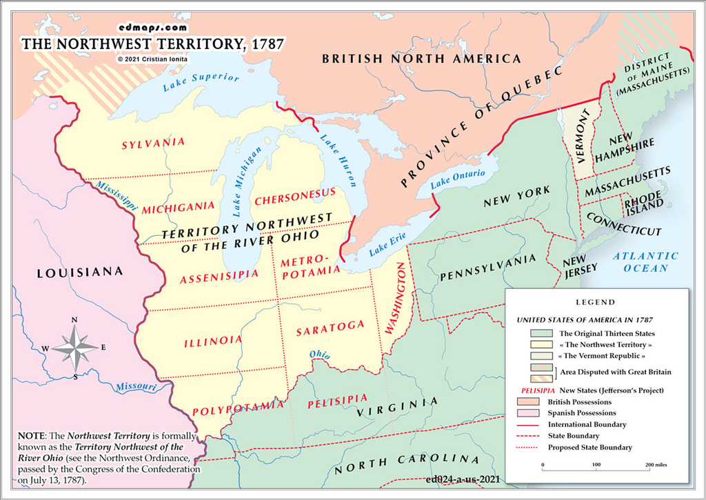
We looked at the maps and the maps were large and open.
There were lines on the maps for rivers and lines for the mountains,
And names of towns that were promises, names like Oregon,
Names like Shenandoah and the Great Plains and the Ohio.
We looked at the map and we saw the history of ourselves written there in the geography—
The history of a people who had nothing to stop them but the sea.
Archibald MacLeish, Land of the Free (1938)