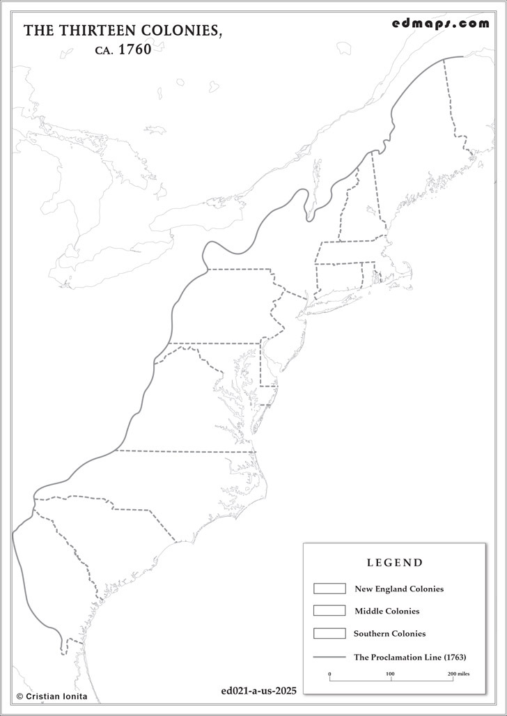
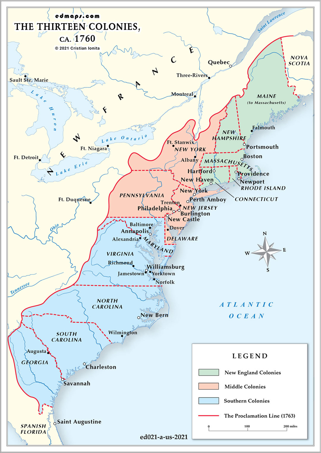
This page presents an original historical map created by Dr. Cristian Ionita for EdMaps, illustrating a key moment in the territorial, political, or administrative evolution of the United States. Designed for educational use, the map offers a clear visual representation of historical developments that shaped the geography and identity of the nation over time.
See also :
Historical Maps of the U.S.A. — original historical maps of the U.S.A.;
More Historical Maps of the U.S.A. — curated links to historical maps and resources covering American history;
The Population of the Original Thirteen Colonies, ca. 1760 — a demographic map;
The Thirteen Colonies in 1776 — a map of the Thirteen colonies before the Declaration of Independence;
The U.S.A. in 1783 — a map of the new state after the Treaty of Paris.
This map depicts the Thirteen Colonies in 1763, following the end of the French and Indian War. It highlights the territorial organization of British North America, the colonial boundaries, and the geopolitical context that shaped the early development of the future United States.
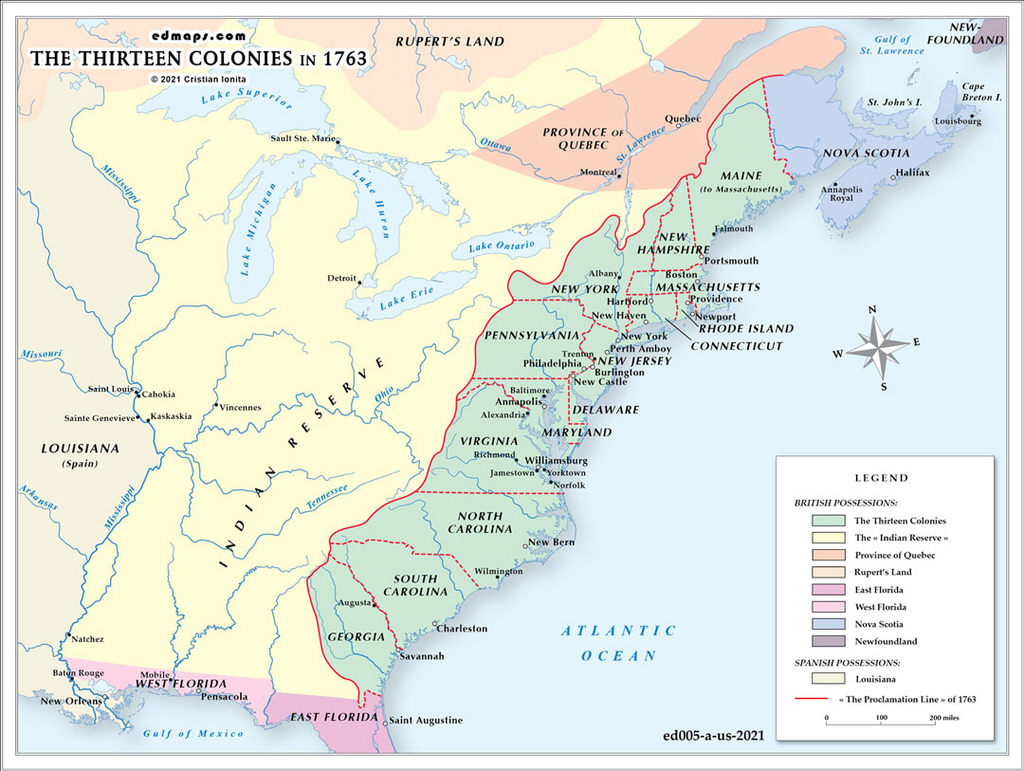
In 1763, following the Treaty of Paris that ended the Seven Years' War (French and Indian War), the thirteen American colonies existed within a dramatically transformed territorial landscape under British rule.
The thirteen colonies stretched along the Atlantic seaboard: New Hampshire, Massachusetts (including present-day Maine), Rhode Island, Connecticut, New York, New Jersey, Pennsylvania, Delaware, Maryland, Virginia, North Carolina, South Carolina, and Georgia. Each colony possessed distinct governmental structures, with royal colonies (Virginia, New York, New Jersey, North Carolina, South Carolina, Georgia), proprietary colonies (Pennsylvania, Delaware, Maryland), and charter colonies (Massachusetts, Rhode Island, Connecticut, New Hampshire) operating under different administrative frameworks.
The Treaty of Paris transferred vast French territories east of the Mississippi River to British control, including the Great Lakes region and the Ohio Valley. This acquisition effectively doubled British North American territory and opened enormous possibilities for colonial expansion westward from the Appalachian Mountains.
King George III's Royal Proclamation of 1763 established a boundary line along the Appalachian crest, prohibiting colonial settlement west of this demarcation. This policy aimed to prevent conflicts with Native American tribes, reduce administrative costs, and maintain imperial control over westward expansion. The proclamation created immediate tensions with colonists who viewed western lands as rightful expansion territory.
Britain established new governmental structures for acquired territories, including the provinces of Quebec, East Florida, and West Florida. These additions required new administrative frameworks and military garrisons, significantly increasing imperial expenses.
Several colonies possessed sea-to-sea charter claims extending theoretically to the Pacific Ocean, including Virginia, Massachusetts, Connecticut, North Carolina, South Carolina, and Georgia. These overlapping claims would later create significant territorial disputes. The proclamation effectively suspended these western claims, generating resentment among colonial land speculators and settlers who had invested in western ventures.
Sources, Methodology & Educational Use: This map was produced by Dr. Cristian Ionita for EdMaps using verified historical data from colonial archives, federal repositories, state historical societies, and early government cartographic publications. Its design follows established practices in historical cartography, including source verification, period contextualization, and visual clarity. The collection supports teaching, learning, and public understanding of U.S. historical geography, and is intended for educational and non‑commercial use.
EdMaps — Historical Cartography for Education
EdMaps provides original maps and curated historical maps designed to support teaching, learning, and public understanding of territorial evolution and administrative history. The original maps are created by Dr. Cristian Ionita, and all curated maps are selected from public archives, historical collections, and private holdings, and are presented for educational and non‑commercial use.
© EdMaps. All rights reserved.
Website: https://edmaps.com — Contact: info@edmaps.com