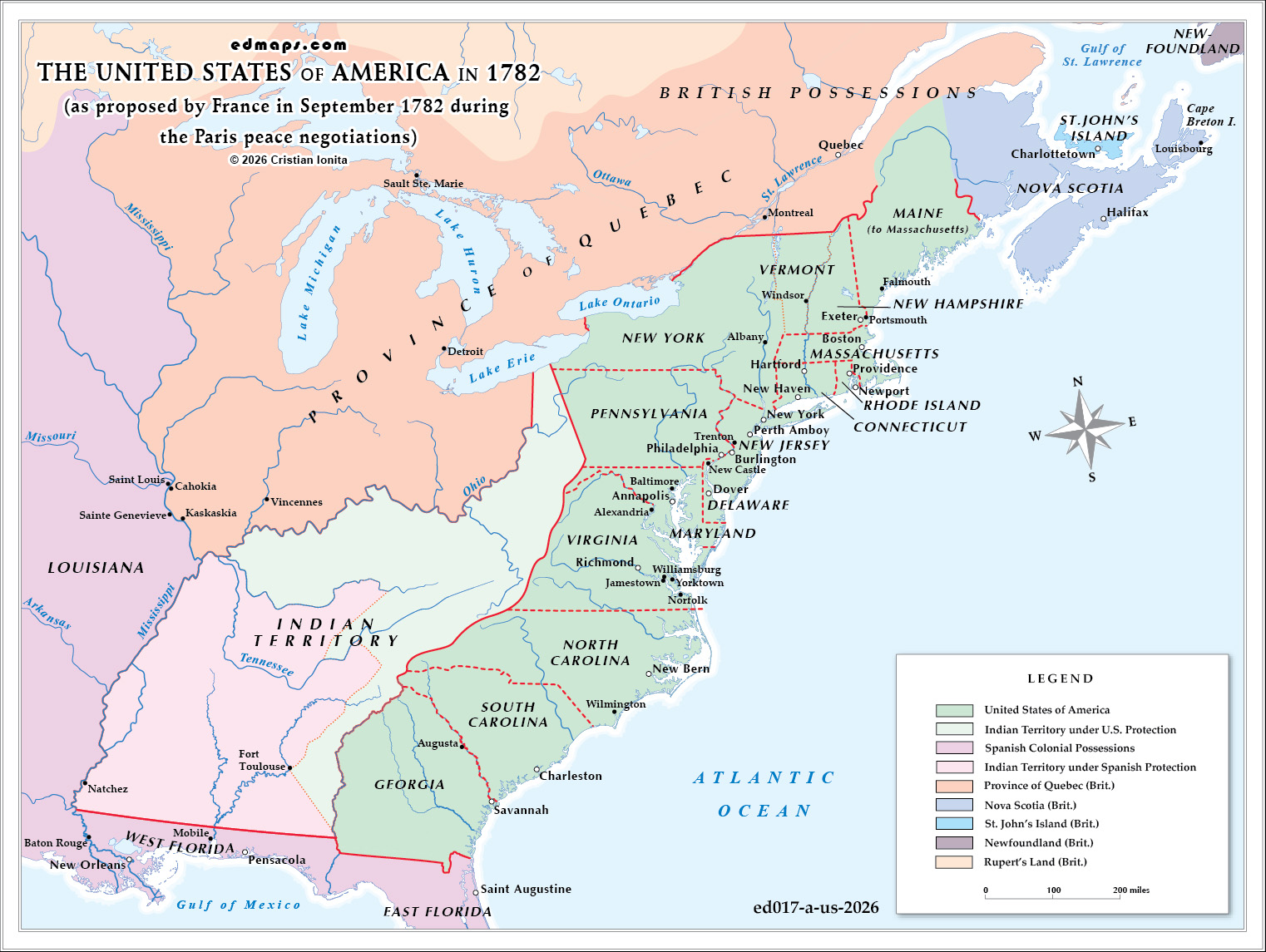
In September 1782, as diplomats gathered in Paris to negotiate an end to the American Revolutionary War, France presented a proposal that would have dramatically reshaped the territorial future of North America. The Rayneval memorandum, named after French diplomat Joseph Matthias Gérard de Rayneval, outlined boundaries for the nascent United States that were far more restrictive than what American negotiators sought or would ultimately achieve.
France's vision reflected its desire to balance power on the continent while satisfying its Spanish ally. The proposal would have confined the United States to a relatively narrow band along the Atlantic coast, extending westward only to the Appalachian Mountains or, at most, to a line considerably east of the Mississippi River. The Ohio River would serve as the northern boundary, beyond which the Province of Quebec—retained by Britain—would maintain its extensive territorial claims southward.
The most striking feature of the French proposal was the creation of vast Indian territories in the continental interior. These lands, situated between the Appalachians and the Mississippi River and south of the Ohio River, would be designated as autonomous Native American territories under the joint protection of Spain and the United States. This arrangement aimed to create a buffer zone that would limit American expansion westward while acknowledging Indigenous sovereignty—though under European supervision.
France's motives were complex. As America's crucial wartime ally, France sought to ensure British defeat, but not necessarily American dominance. The proposed boundaries would create a weaker United States dependent on French goodwill, while strengthening Spain's position in North America. Spain, which controlled Louisiana and Florida, feared aggressive American expansion toward its territories and favored substantial Native American buffer states.
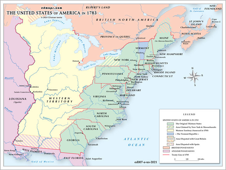
American negotiators, particularly John Jay and Benjamin Franklin, viewed these proposals with alarm. They recognized that accepting such boundaries would strangle the new republic's growth and trap it along the eastern seaboard. Through skillful diplomacy—including separate negotiations with Britain that technically violated their alliance with France—the Americans ultimately secured far more generous terms in the 1783 Treaty of Paris. The final agreement established the Mississippi River as the western boundary, the Great Lakes region as the northern frontier, and incorporated the vast territory south of the Great Lakes and north of Florida into the United States, laying the foundation for future westward expansion and rendering the French vision of protected Indian territories largely moot.
Sources, Methodology & Educational Use: The maps presented on this page are original creations produced for edmaps.com by Dr. Cristian Ionita. Each map is based on verified historical data relating to the territorial evolution, administrative structures, and political history of the United States. The maps are designed according to established practices in historical cartography, including source analysis, period contextualization, and visual clarity. The collection is curated to support teaching, learning, and public understanding of the U.S. history, and is intended for educational and non‑commercial use.
edmaps.com — Historical Cartography for Education
edmaps.com provides original maps and curated historical maps designed to support teaching, learning, and public understanding of territorial evolution, political history, etc. The original maps are created by Dr. Cristian Ionita, and all curated maps are selected from public archives, historical collections, and private holdings, and are presented for educational and non‑commercial use.
© Cristian Ionita. All rights reserved.
Website: https://edmaps.com — Contact: info@edmaps.com