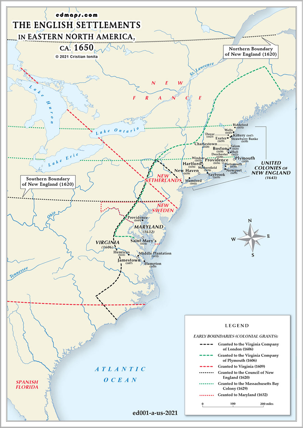
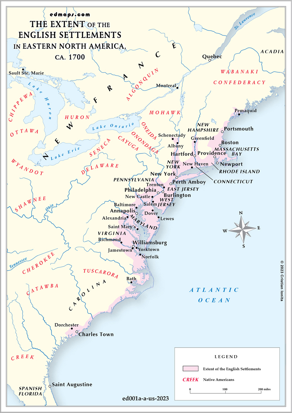
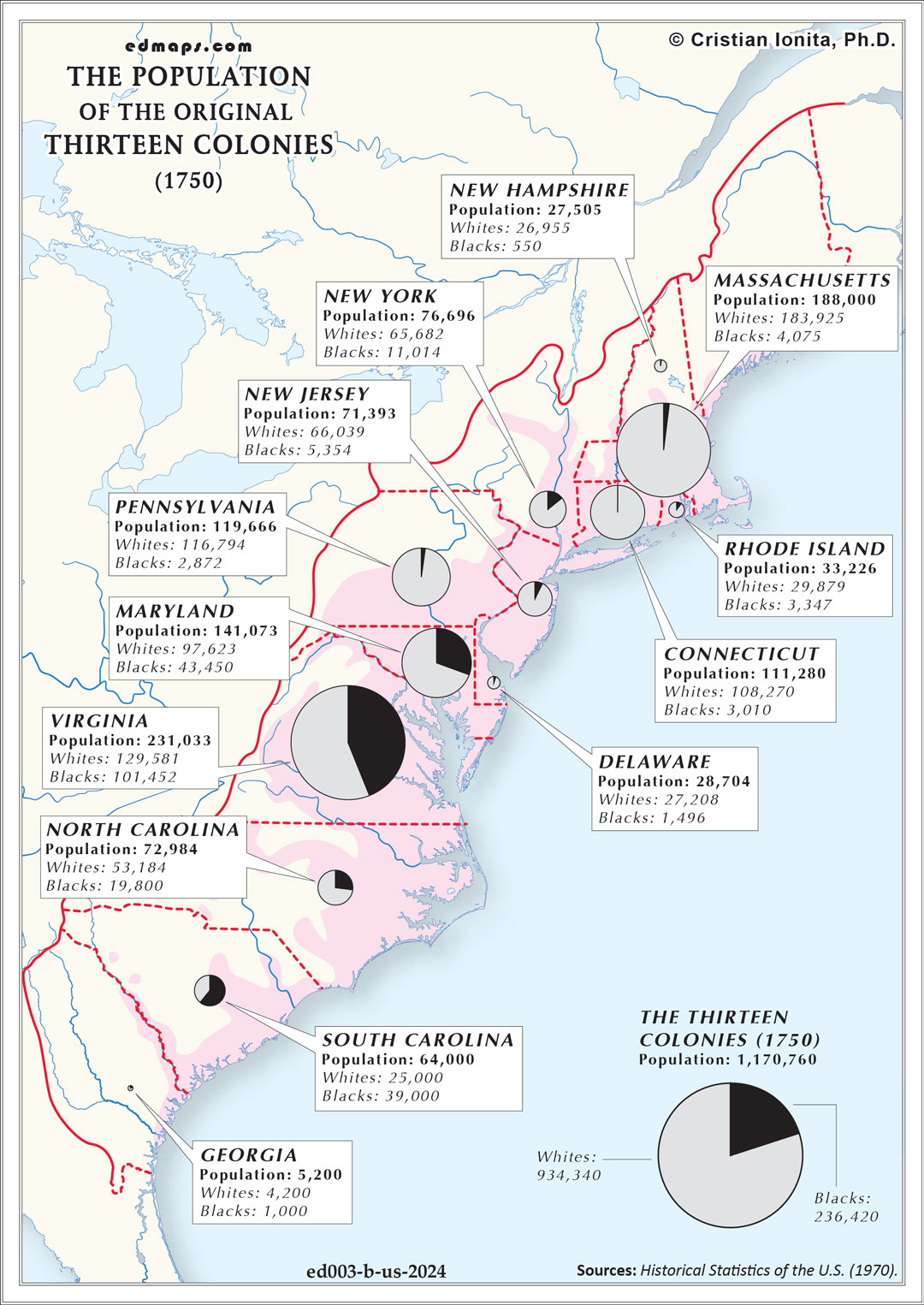
In 1750, the Thirteen Colonies had reached a population of approximately 1.17 million people, representing remarkable growth from earlier decades and establishing the foundation for future expansion.
Virginia remained the most populous colony with an estimated 231,000 residents, benefiting from its extensive tobacco cultivation and established settlements. Massachusetts followed with approximately 188,000 inhabitants, while Pennsylvania had grown rapidly to around 120,000 people due to substantial German and Scots-Irish immigration. Connecticut (111,000), Maryland (141,000), and North Carolina (73,000) comprised the other major population centers.
New York contained roughly 77,000 residents, while South Carolina had approximately 64,000. New Jersey (72,000), New Hampshire (28,000), Rhode Island (33,000), Delaware (28,000), and Georgia (5,200) represented smaller but growing populations. Georgia remained the least populous, having been founded only in 1733.
The colonial population was ethnically diverse, with English colonists forming the largest group but constituting less than half the total population. Significant communities included Germans (particularly in Pennsylvania), Scots-Irish throughout the backcountry, Dutch in New York and New Jersey, and French Huguenots in South Carolina and other colonies.
Approximately 200,000 enslaved Africans and their descendants comprised roughly 17% of the total colonial population. The highest concentrations existed in the Chesapeake colonies (Virginia and Maryland) and South Carolina, where plantation agriculture drove demand for enslaved labor. South Carolina had achieved a black majority population by 1750.
Colonial cities remained small by European standards. Philadelphia was the largest with about 13,000 residents, followed by Boston (12,000) and New York (11,000). Despite their modest size, these urban centers served as crucial commercial, cultural, and political hubs.
The colonial population was doubling approximately every twenty-five years through natural increase and continued immigration, creating pressures for westward expansion that would intensify territorial conflicts with French and Native American populations.
Sources, Methodology & Educational Use: The maps presented on this page are original creations produced for edmaps.com by Dr. Cristian Ionita. Each map is based on verified historical data relating to the territorial evolution, administrative structures, and political history of the United States. The maps are designed according to established practices in historical cartography, including source analysis, period contextualization, and visual clarity. The collection is curated to support teaching, learning, and public understanding of the U.S. history, and is intended for educational and non‑commercial use.
edmaps.com — Historical Cartography for Education
edmaps.com provides original maps and curated historical maps designed to support teaching, learning, and public understanding of territorial evolution and administrative history. The original maps are created by Dr. Cristian Ionita, and all curated maps are selected from public archives, historical collections, and private holdings, and are presented for educational and non‑commercial use.
© Cristian Ionita. All rights reserved.
Website: https://edmaps.com — Contact: info@edmaps.com