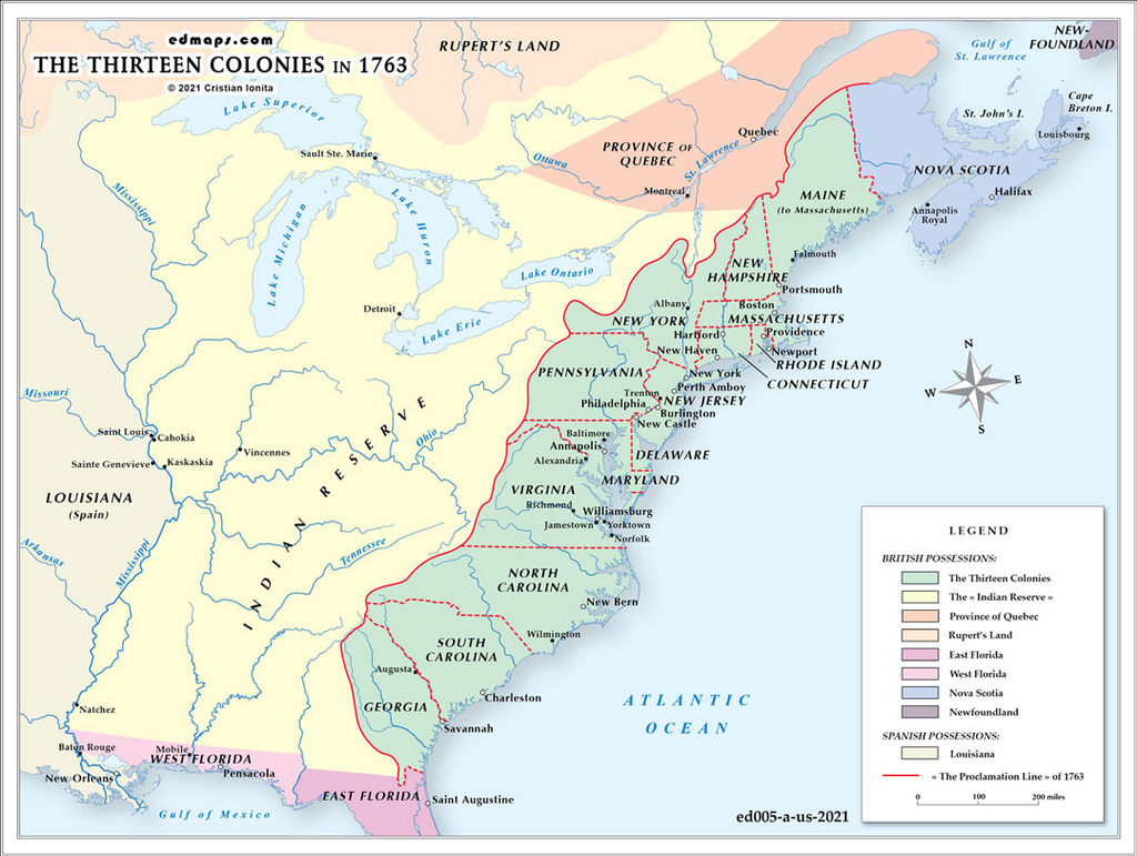
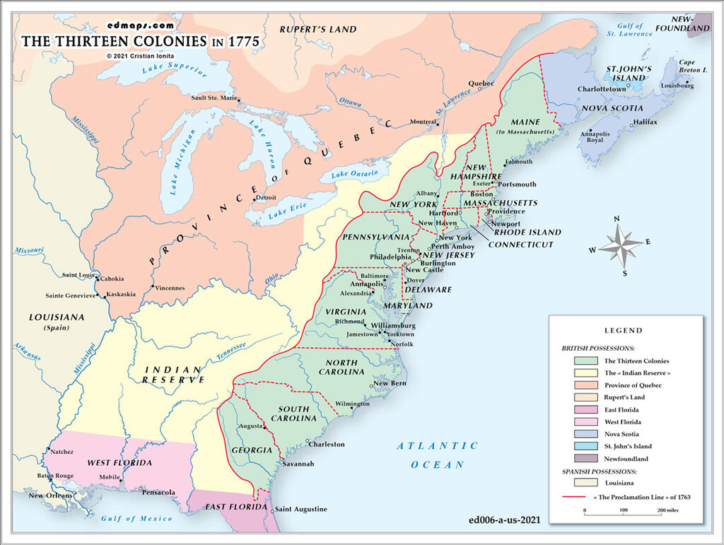
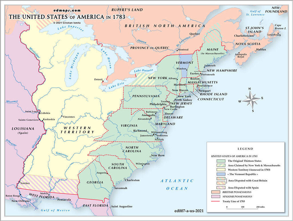
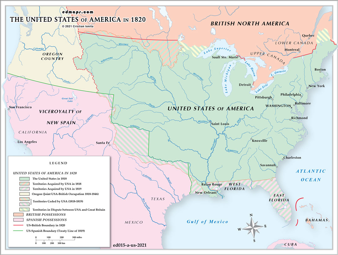
By 1820, the United States had experienced dramatic territorial expansion through the Louisiana Purchase and subsequent acquisitions, creating a complex mosaic of twenty-three states and multiple territories.
The nation comprised twenty-three states following significant additions during the 1810s. Maine achieved statehood in 1820 as part of the Missouri Compromise, separated from Massachusetts. Other additions included Louisiana (1812), Indiana (1816), Mississippi (1817), Illinois (1818), and Alabama (1819). Missouri's statehood remained contentious, finally resolved through the Missouri Compromise of 1820, which admitted Missouri as a slave state while Maine entered as a free state.
The Missouri Territory encompassed much of the Louisiana Purchase north of Arkansas, extending to the Canadian border. The Arkansas Territory was created in 1819 from the southern portion of Missouri Territory. The Michigan Territory included present-day Michigan, Wisconsin, and parts of Minnesota. Florida remained under Spanish control but was being negotiated for American acquisition through the Adams-Onís Treaty.
This pivotal legislation established the 36°30' parallel as the boundary between future slave and free territories within the Louisiana Purchase, temporarily resolving sectional tensions over slavery's expansion. The compromise demonstrated how territorial organization had become inextricably linked with the slavery question.
Vast unorganized territories stretched to the Pacific, including the Oregon Country (jointly occupied with Britain) and Spanish-controlled lands in the Southwest. These regions remained largely unexplored and ungoverned by American authorities.
Territorial governance had become more systematized, with appointed governors, territorial legislatures, and federal courts managing local affairs. The Northwest Ordinance model continued guiding territorial progression toward statehood.
Indigenous nations maintained significant territorial control, particularly in the Great Lakes region, Southeast, and trans-Mississippi west, creating ongoing conflicts between federal territorial claims and tribal sovereignty.
Sources, Methodology & Educational Use: The maps presented on this page are original creations produced for edmaps.com by Dr. Cristian Ionita. Each map is based on verified historical data relating to the territorial evolution, administrative structures, and political history of the United States. The maps are designed according to established practices in historical cartography, including source analysis, period contextualization, and visual clarity. The collection is curated to support teaching, learning, and public understanding of the U.S. history, and is intended for educational and non‑commercial use.
edmaps.com — Historical Cartography for Education
edmaps.com provides original maps and curated historical maps designed to support teaching, learning, and public understanding of territorial evolution, political history, etc. The original maps are created by Dr. Cristian Ionita, and all curated maps are selected from public archives, historical collections, and private holdings, and are presented for educational and non‑commercial use.
© Cristian Ionita. All rights reserved.
Website: https://edmaps.com — Contact: info@edmaps.com