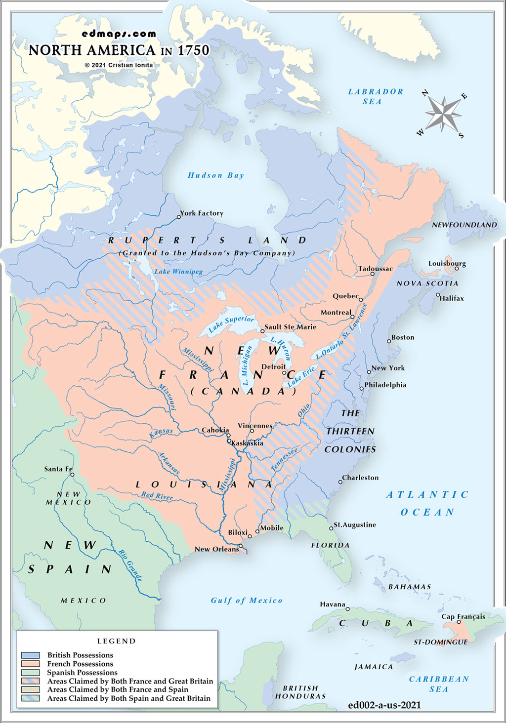
In 1750, North America was divided among four major European powers, with vast indigenous territories creating a complex territorial mosaic of competing claims and spheres of influence.
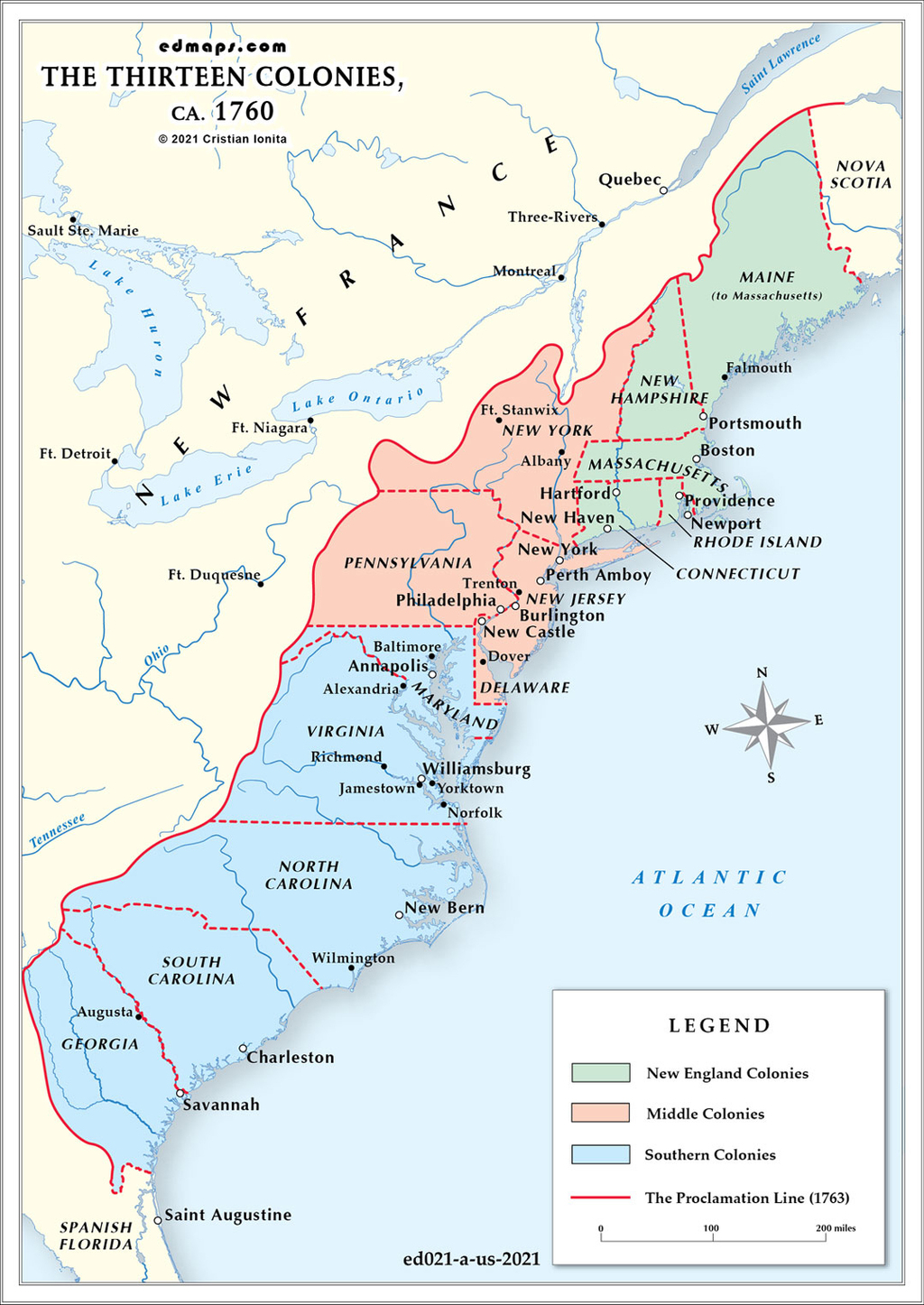
Britain controlled the thirteen Atlantic colonies from Georgia to Maine, plus Nova Scotia and Newfoundland. The Hudson's Bay Company held vast territorial rights across the Canadian Arctic and Great Lakes region under royal charter. British territorial claims theoretically extended westward through sea-to-sea colonial charters, though actual settlement remained largely east of the Appalachian Mountains.
France possessed the most extensive North American territories through New France, encompassing Canada (Quebec), Acadia (Maritime provinces), and Louisiana. The French claimed the entire Mississippi River watershed and Great Lakes region, connected by a strategic arc of forts and trading posts from Quebec to New Orleans. Key administrative centers included Quebec City, Montreal, Detroit, and New Orleans, with the territory divided into the governments of Canada and Louisiana.
Spain controlled Florida, Texas, New Mexico, and California, plus vast territories extending through Mexico to Central America. Spanish Florida included both East and West Florida, with St. Augustine serving as the administrative capital. New Mexico and Texas remained sparsely populated frontier provinces with missions and presidios providing administrative control.
Russian territorial claims existed along the Pacific Northwest coast, primarily focused on fur trading and exploration rather than permanent settlement. Russian America remained largely unexplored and unorganized administratively.
Numerous Native American nations maintained effective territorial control over vast regions, particularly the Iroquois Confederacy in the Northeast, Cherokee and Creek nations in the Southeast, and Plains tribes in the interior. These nations often held the balance of power between competing European empires, forming strategic alliances that shaped territorial control.
Overlapping territorial claims created ongoing tensions, particularly in the Ohio Valley where British, French, and indigenous interests intersected, setting the stage for the French and Indian War.
Sources, Methodology & Educational Use: The maps presented on this page are original creations produced for edmaps.com by Dr. Cristian Ionita. Each map is based on verified historical data relating to the territorial evolution, administrative structures, and political history of the United States. The maps are designed according to established practices in historical cartography, including source analysis, period contextualization, and visual clarity. The collection is curated to support teaching, learning, and public understanding of the U.S. history, and is intended for educational and non‑commercial use.
edmaps.com — Historical Cartography for Education
edmaps.com provides original maps and curated historical maps designed to support teaching, learning, and public understanding of territorial evolution and administrative history. The original maps are created by Dr. Cristian Ionita, and all curated maps are selected from public archives, historical collections, and private holdings, and are presented for educational and non‑commercial use.
© Cristian Ionita. All rights reserved.
Website: https://edmaps.com — Contact: info@edmaps.com