Skip to main content
Home
Historical Maps
World History
U.S. History
Canadian History
Canada (English)
Canada (Français)
Old School History Maps
Stories on the Map
Armenia
Assyria
Catalonia
Kurdistan
Palestine
Ukraine
Edmaps +
Historical Maps of Pennsylvania
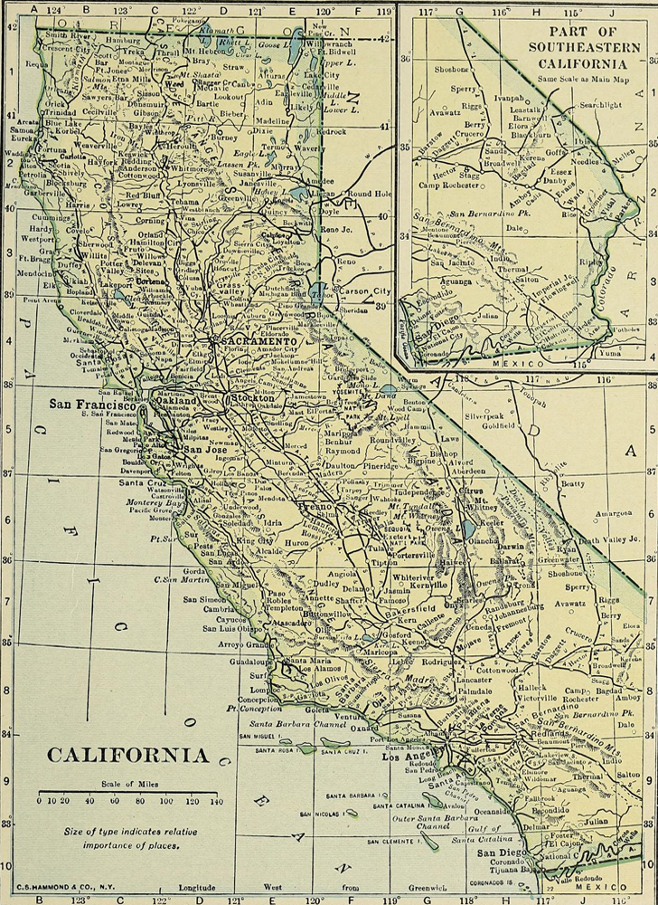
California
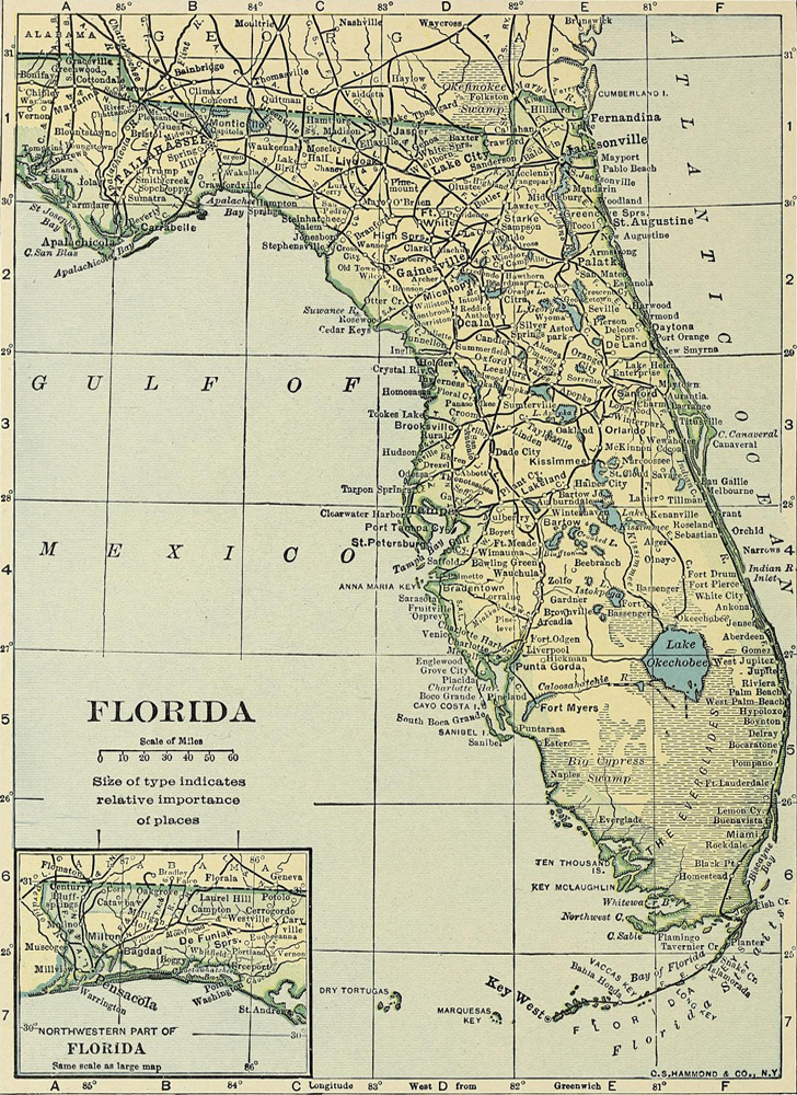
Florida
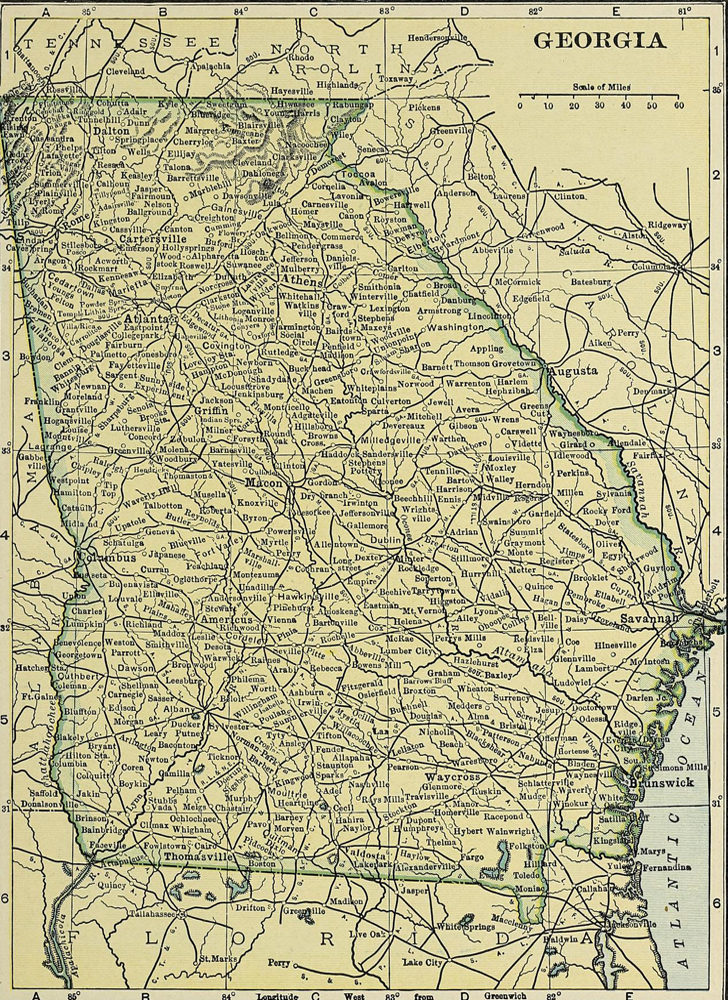
Georgia
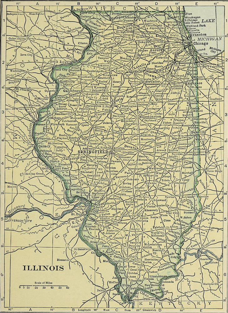
Illinois
Michigan
New York
North Carolina
Ohio
Pennsylvania
Texas
Virginia
More States
Map Collections and Atlases
Blank and Outline Maps of Pennsylvania
(d-maps.com)
Genealogical Maps of the counties of Pennsylvania
Historical Maps of Pennsylvania
(American Geographical Society Library Digital Map Collection)
Historical Maps of Pennsylvania
(Beinecke Library - Yale University)
Historical Maps of Pennsylvania
(David Rumsey Map Collection)
Historical Maps of Pennsylvania
(mapsofpa.com)
Historical Maps of Pennsylvania
(Norman B. Leventhal Map & Education Center - Boston Public Library)
Historical Maps of Pennsylvania
(University of Alabama)
Maps of Pennsylvania
(The New York Public Library - Digital Collections)
Old Maps of Pennsylvania
(oldmapsonline.org)
Pennsylvania: Atlas of Historical County Boundaries
(Newberry Library)
Pennsylvania County Atlases and Maps from the 1850s-1870s
(Pennsylvania State Archives)
Pennsylvania Historic Base Map Layers
(Penn State University Libraries)
Pennsylvania: Historical Maps Collection
(Library of Congress)
Pennsylvania: Map Collections in the Pennsylvania Historical and Museum Commission
(Pennsylvania State Archives)
Pennsylvania Maps
(Perry-Castañeda Library Map Collection - University of Texas Libraries)
Western Pennsylvania Maps
(Historic Pittsburgh - University of Pittsburgh Library System)
Maps
Pennsylvania, 1791
The State of Pennsylvania from the latest surveys, 1796
(J. Reid)
A New Map of the State of Pennsylvania, 1811
(Reading Howell)
Map of Pennsylvania, New Jersey and Delaware, 1826
(D. Vance)
Pennsylvania, 1829
(A. Finley)
Map of the states of Pennsylvania and New Jersey, 1832
(M. Simpkin)
A New Map of Pennsylvania..., 1840
(H. Tanner)
Industrial and Political Map of Pennsylvania, 1844
(Edward Biddle)
Pennsylvania, Virginia, Delaware and Maryland, 1862
(Johnson and Browning)
An Historical Map of Pennsylvania, 1875
(P.W. Sheafer)
Pennsylvania, 1886
(George Cram)
Pennsylvania, New Jersey, 1901
(W. Johnston)
Pennsylvania, 1906
(C. Hammond)
Pennsylvania, 1906
(Rand McNally)
Pennsylvania, 1911
(George Cram)
Pennsylvania, 1927
(Rand McNally0
Pennsylvania, 1930
(C. Hammond)
Pennsylvania, 1944: State Farm Road Map
(Rand McNally)
More State Maps
California
Florida
Georgia
Illinois
MORE HISTORICAL MAPS
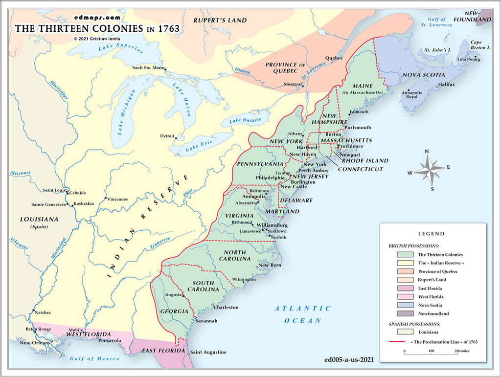
The Thirteen Colonies in 1763
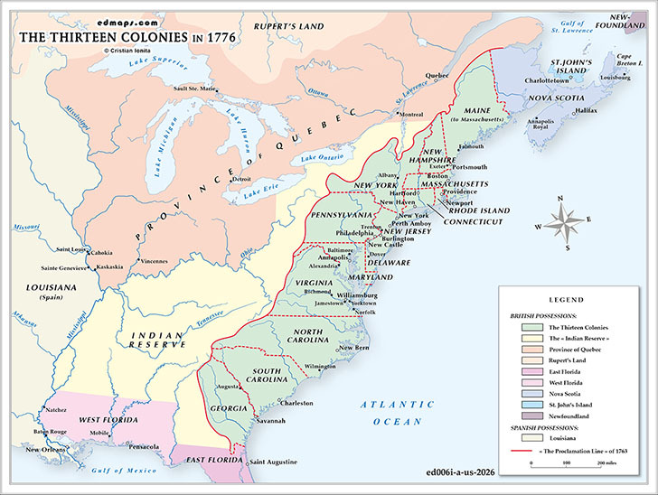
The Thirteen Colonies in 1776 (before the Declaration of Independence)
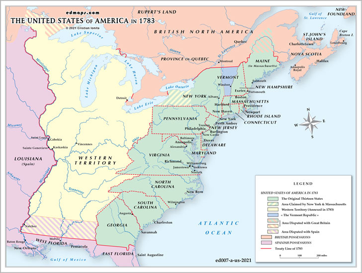
U.S.A. in 1783

