Skip to main content
Home
Historical Maps
World History
U.S. History
Canadian History
Canada (English)
Canada (Français)
Old School History Maps
Stories on the Map
Armenia
Assyria
Catalonia
Kurdistan
Palestine
Ukraine
Edmaps +
U.S. History: North America Maps
World
Europe
Asia
Latin America
Canada
U.S.A.
Australia
Map Collections and Atlases
Blank and Outline Maps of North America
(d-maps.com)
American Revolution: Maps and Charts of North America & West Indies, 1750-1789
(Library of Congress Collection)
Caribbean Map Collections
(University of Florida Digital Collections - G. A. Smathers Libraries)
Cartes d’Amérique du Nord, d’Amérique Centrale et des Caraïbes
(Gallica - Bibliothèque nationale de France)
Historia del mapa de México
(Gonzalo Prieto - geografiainfinita.com)
Historical Maps: Caribbean and Central America
(New York Public Library)
Historical Maps of North America
(American Geographical Society Library Digital Map Collection)
Historical Maps of North America
(David Rumsey Map Collection)
Historical Maps of North America
(University of Alabama)
Historical Maps of the Mexican-American War
(University of Alabama)
México: 20 mapas que muestran como su territorio ha cambiado desde la Independencia
(Darinka Rodriguez)
North America: Historical Maps Collection
(Library of Congress)
Old Maps of North America
(oldmapsonline.org)
Panama Canal: Maps and Blueprints
(Linda Hall Library)
Reference Maps on the Spanish-American War, 1898
The Spanish-American War Maps
(Norman B. Leventhal Map & Education Center)
The War of 1812
(Government of Ontario)
The War of 1812
(Toronto Public Library)
War of 1812 in Maps
(War of 1812 Bicentennial)
War Maps of Cuba, Porto Rico, and the Philippines
(Norman B. Leventhal Map & Education Center)
Maps
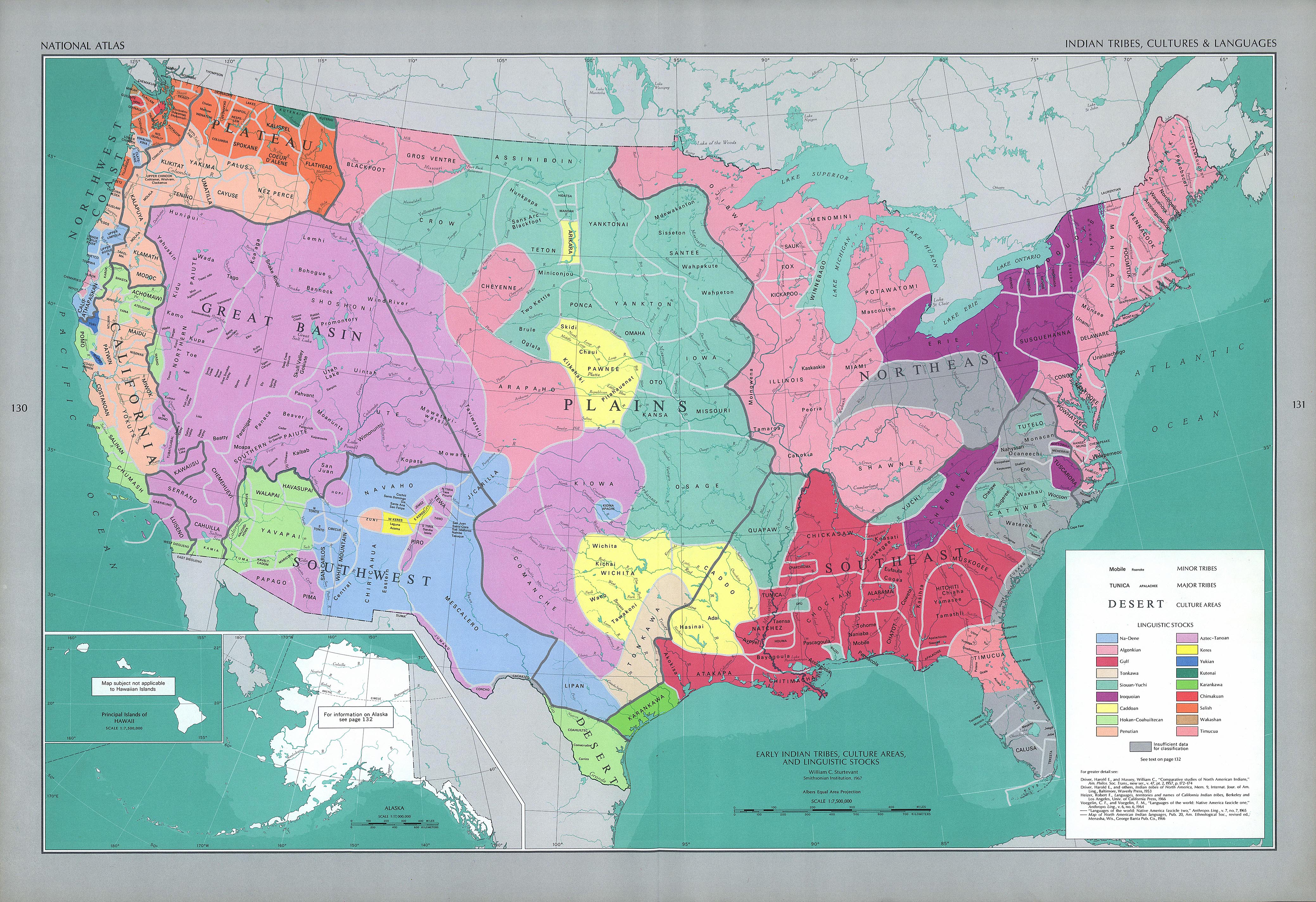
Indian Tribes, Culture and Languages
(The National Atlas of the United States of America, 1970)
Discovery of North America
(The National Atlas of the United States of America, 1970)
North America
(Droysens Allgemeiner Historischer Handatlas, 1886)
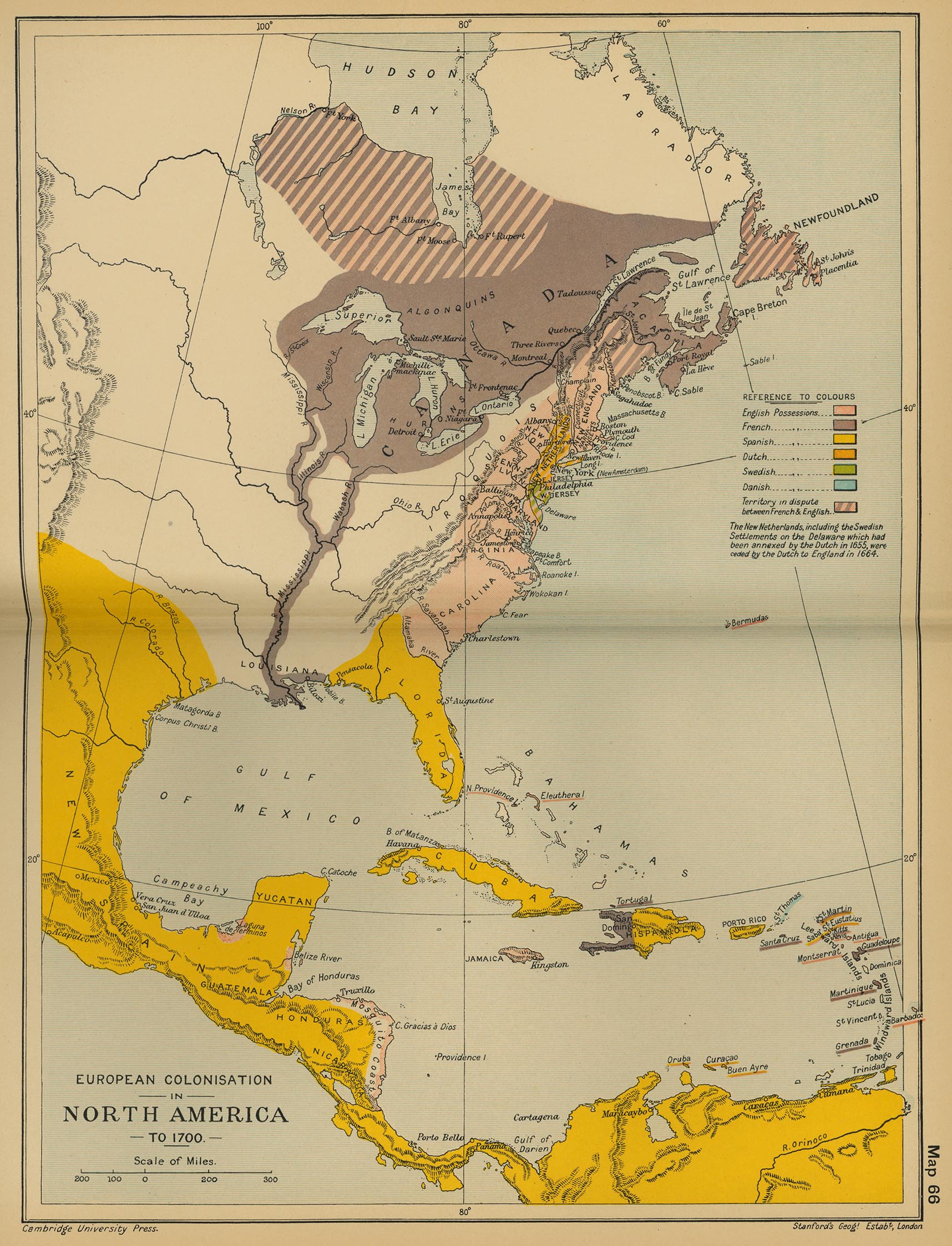
European Colonisation in North America, c. 1700
(Cambridge Modern History Atlas, 1912)
British and French Settlements in North America, 1755
(John Hinton)
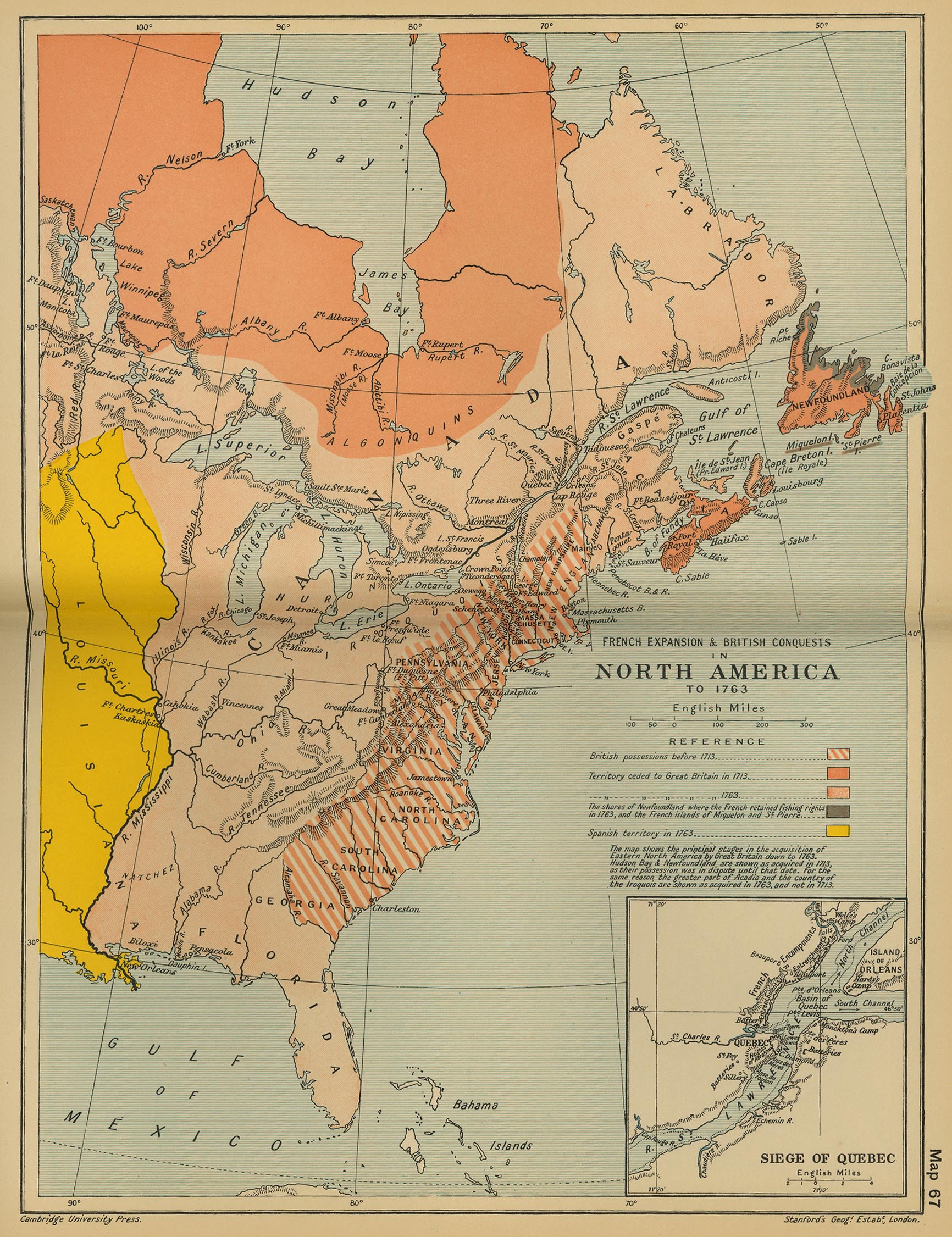
French Expansion and British Conquests in North America, c. 1763
(Cambridge Modern History Atlas, 1912)
North America, 1776
North America, c. 1763
(Putzgers Historischer Weltatlas, 1923)
Boundaries after the Treaty of Paris, 1763
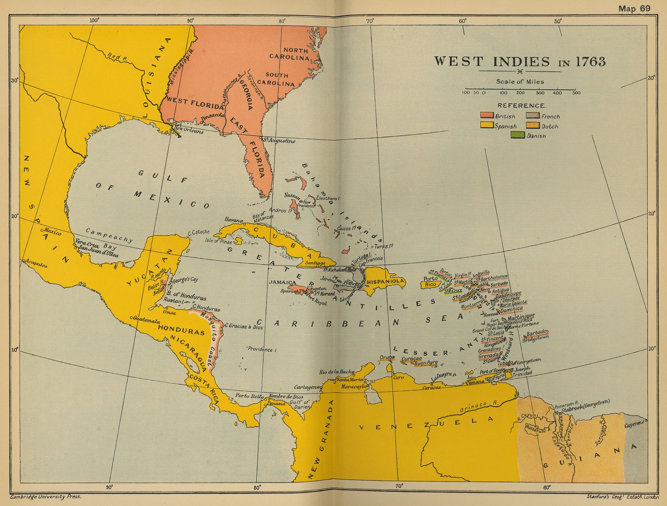
West Indies in 1763
(Cambridge Modern History Atlas, 1912)
The War of 1812
(McConnell’s Historical Maps of the United States, 1919)
North America, 1836
(Tanner’s Universal Atlas)
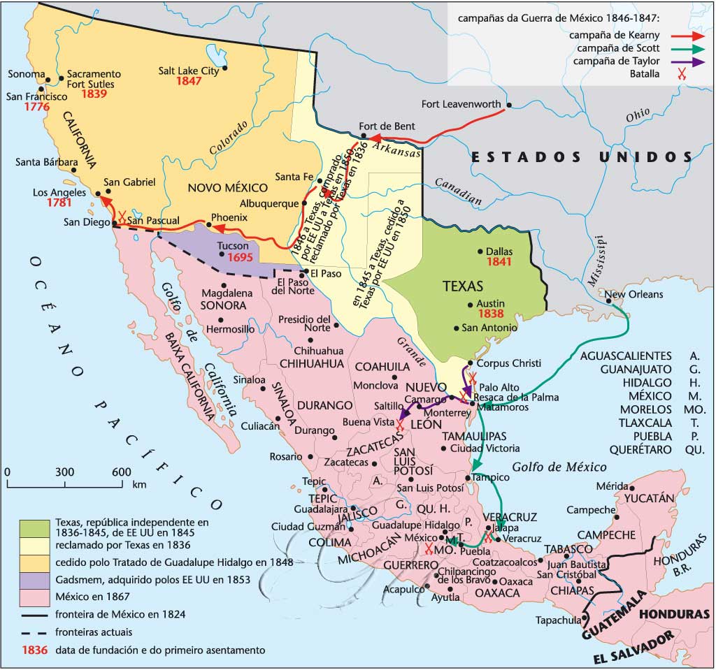
Mexico, 1824-1867
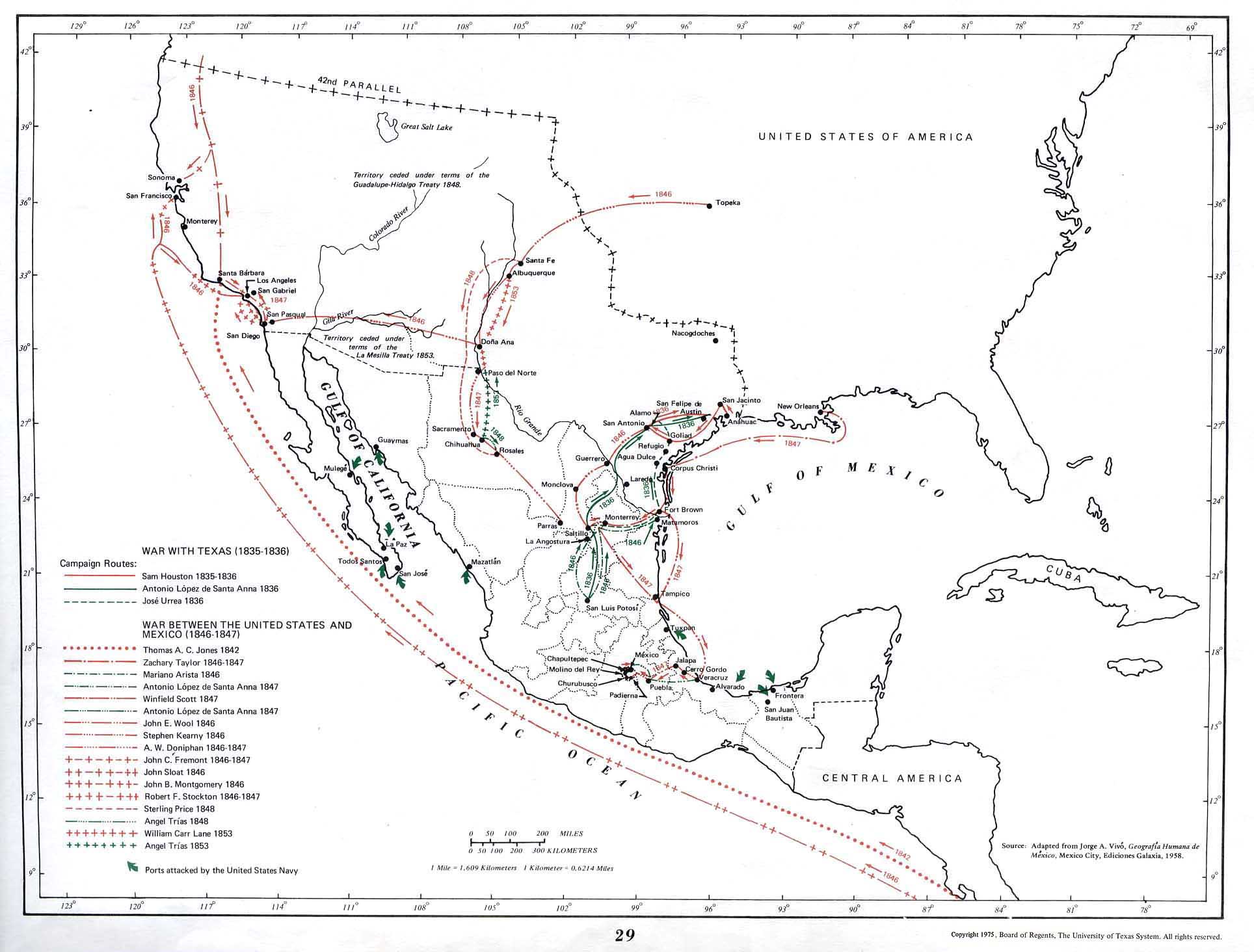
War with Texas (1835-1836)
(S. Arbingast et alii, Atlas of Mexico, 1975)
Territorial Division of Mexico, 1835-1846
(Wikipedia)
North America, 1845
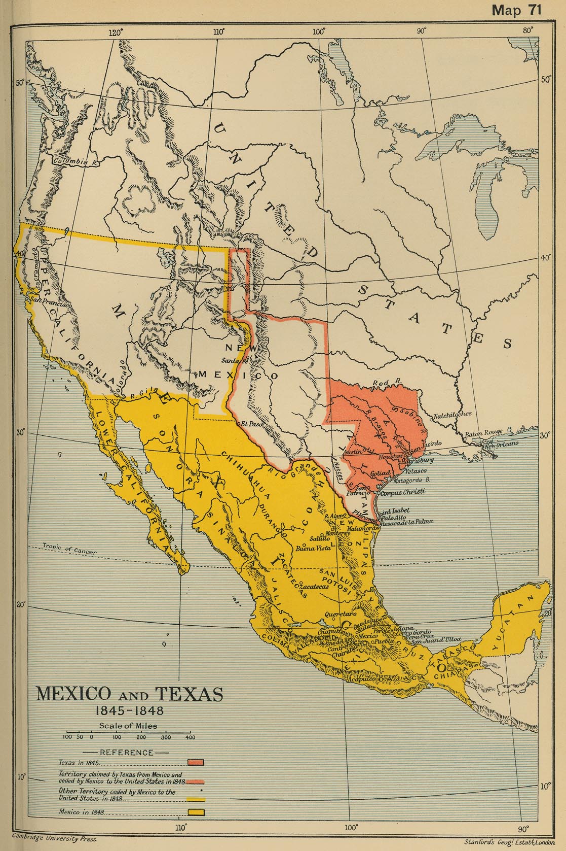
Mexico and Texas, 1845-1848
(Cambridge Modern History Atlas, 1912)
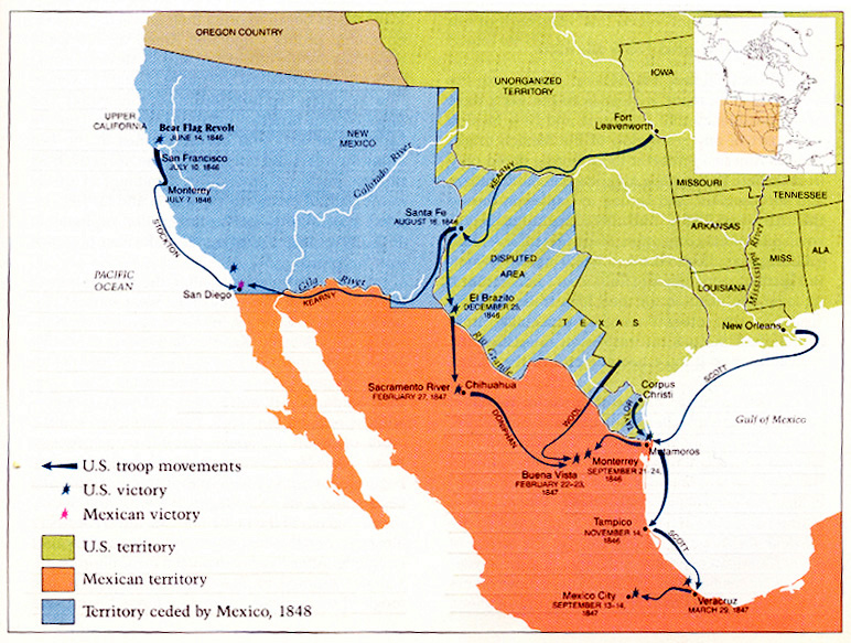
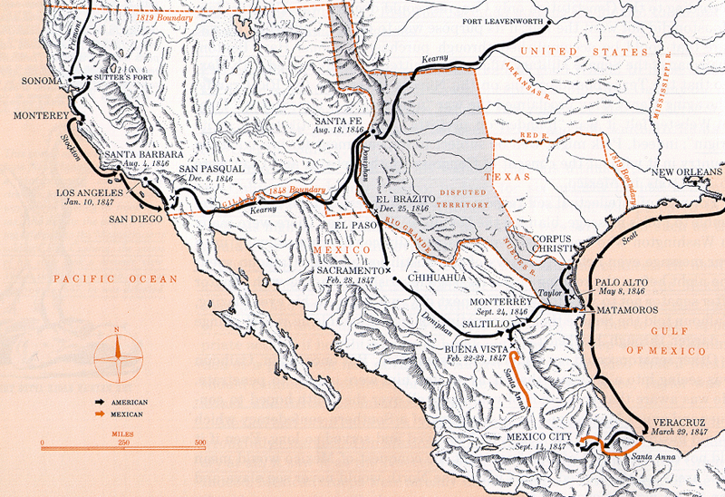
Mexican War (a)
Mexican War (b)
Oregon Treaty, 1846
Cuba, 1851
The Spanish-American War, 1898
(McConnell’s Historical Maps of the United States, 1919)
The Spanish-American War, 1898-1899
(Pearson)
Cuban Battlefields of the Spanish-Cuban-American War
(University of Nebraska-Lincoln)
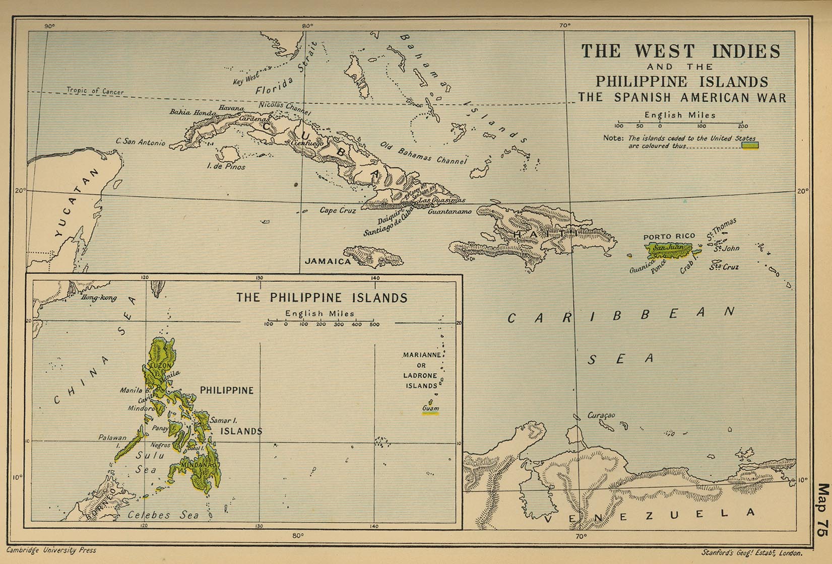
The West Indies and the Philippine Islands: The Spanish American War
(Cambridge Modern History Atlas, 1912)
American Involvement in Latin America, 1898-1939
(Pearson)
The Panama Canal
(McConnell’s Historical Maps of the United States, 1919)
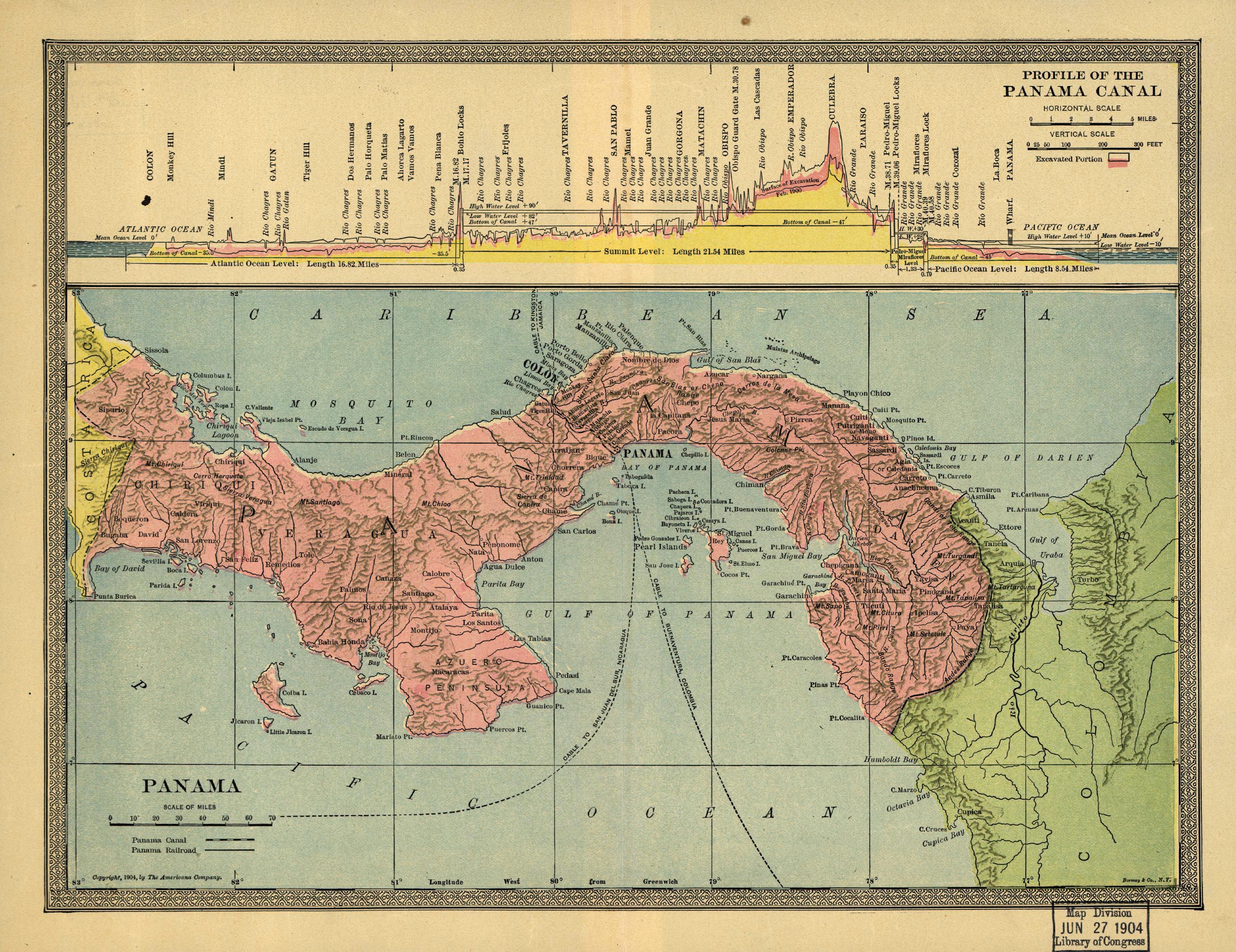
Panama Canal, 1904
Panama Canal: Maps and Blueprints
North America - Political Map, 1920
(J.G. Bartholomew)
US intervention in Latin America since 1945
Soviet Military Buildup in Cuba
The Cuban Missile Crisis: Map of Missile Range
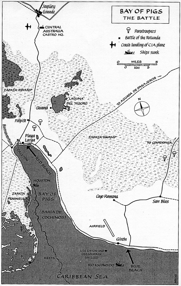
Bay of Pigs - The Battle

