Skip to main content
Home
Historical Maps
World History
U.S. History
Canadian History
Canada (English)
Canada (Français)
Old School History Maps
Stories on the Map
Armenia
Assyria
Catalonia
Kurdistan
Palestine
Ukraine
Edmaps +
U.S. History: Nation-Scale Maps
World
Europe
Asia
Latin America
Canada
U.S.A.
Australia
Map Collections and Atlases
Atlas of the Historical Geography of the United States
(Paulin & Wright, 1932)
Blank and Outline Maps of the USA
(Histgeo)
Blank and Outline Maps of the USA
(d-maps.com)
Blank and Outline Maps of the USA
(Coloring Castle)
Color Landform Atlas of the United States
Historical Maps of the American Revolution
(University of Alabama)
Historical Maps of the Mexican-American War
(University of Alabama)
Historical Maps of the United States
(University of Alabama)
Maps of the French and Indian War
(The Massachusetts Historical Society)
McConnell’s Historical Maps of the United States
(McConnell Map Co., 1919)
Outline Maps of the USA
(Enchanted Learning)
Robertson’s Geographic-Historical Series Illustrating the History of America and the United States: from 1492 to the Present Time
(R. O. Evans and Co., 1898)
The Comprenhensive Series, Historical-Geographical Maps of the United States
(Modern School Supply Co., 1919)
U. S. Census Atlases 1870, 1880, 1890
(American Memory)
U. S. Election 2016: Trump victory in maps
(BBC)
U. S. Election 2020: Results and exit poll in maps and charts
(BBC)
U. S. Panoramic Maps 1847-1929
(Libray of Congress)
U. S. Territorial Maps 1775-1920
(University of Virginia)
Maps
North American Colonies, 1643
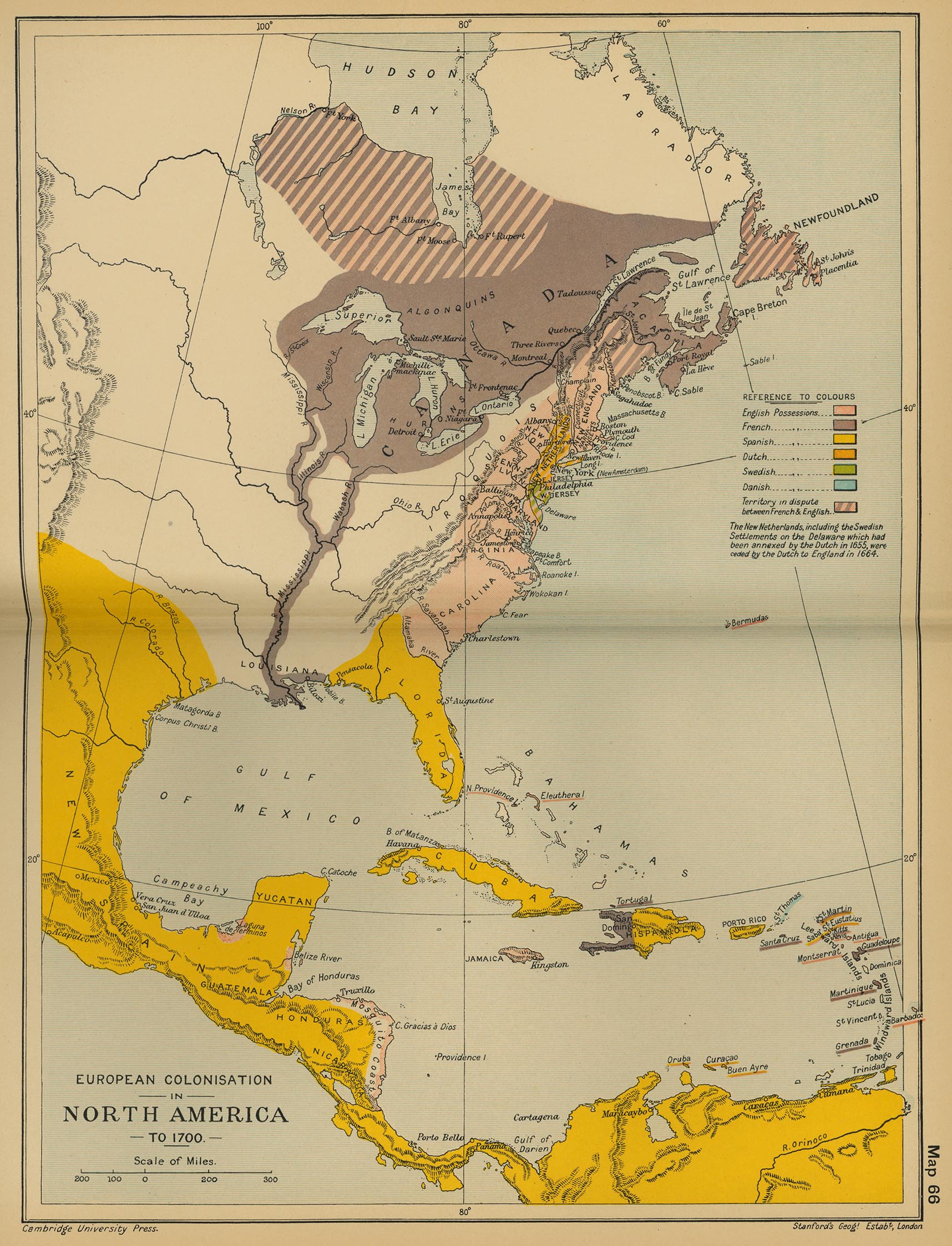
European Colonisation in North America, c. 1700
(Cambridge Modern History Atlas, 1912)
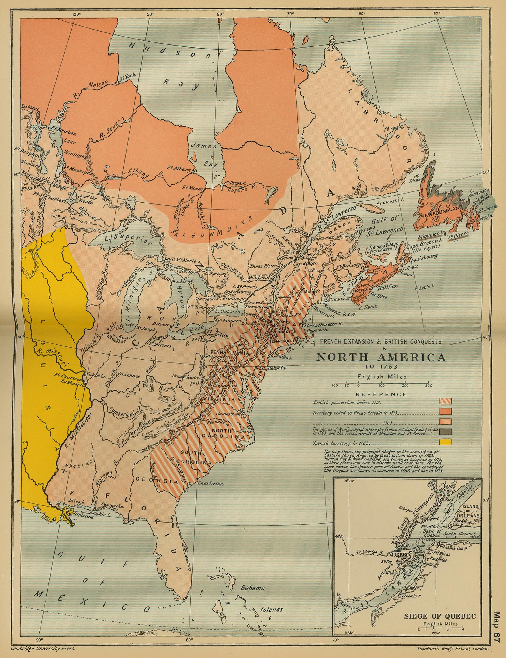
French Expansion and British Conquests in North America, c. 1763
(Cambridge Modern History Atlas, 1912)
North America, c. 1763
(Putzgers Historischer Weltatlas, 1923)
The British Colonies in North America, 1763-1775
(William Shepherd, Historical Atlas, 1923)
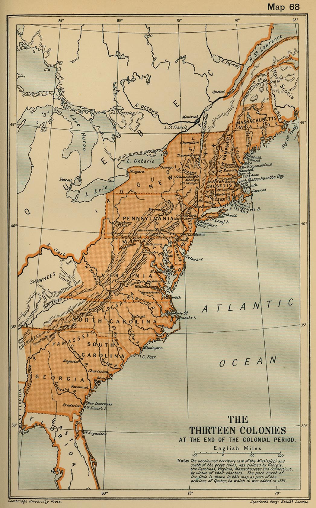
The Thirteen Colonies at the End of the Colonial Period
(Cambridge Modern History Atlas, 1912)
Ohio Country, ca. 1765
Revolutionary War Battles
(National Geographic)
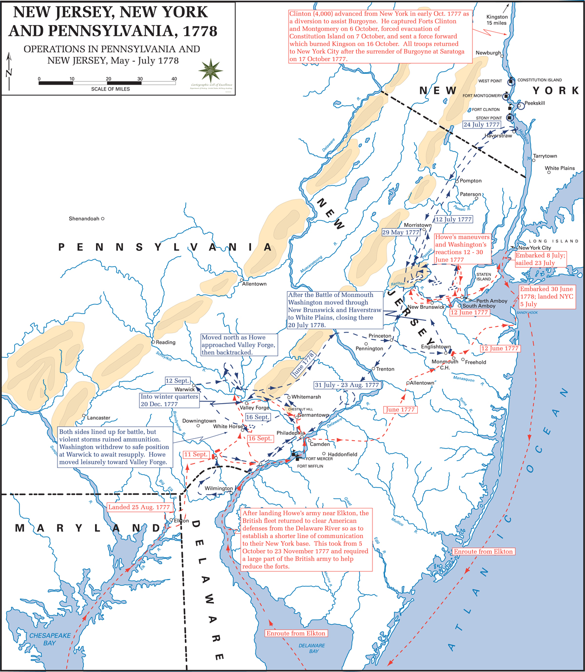
New Jersey, New York and Pennsylvania, 1778
The United States, 1783-1803
(William Shepherd, Historical Atlas, 1923)
A Map of the United States, 1795
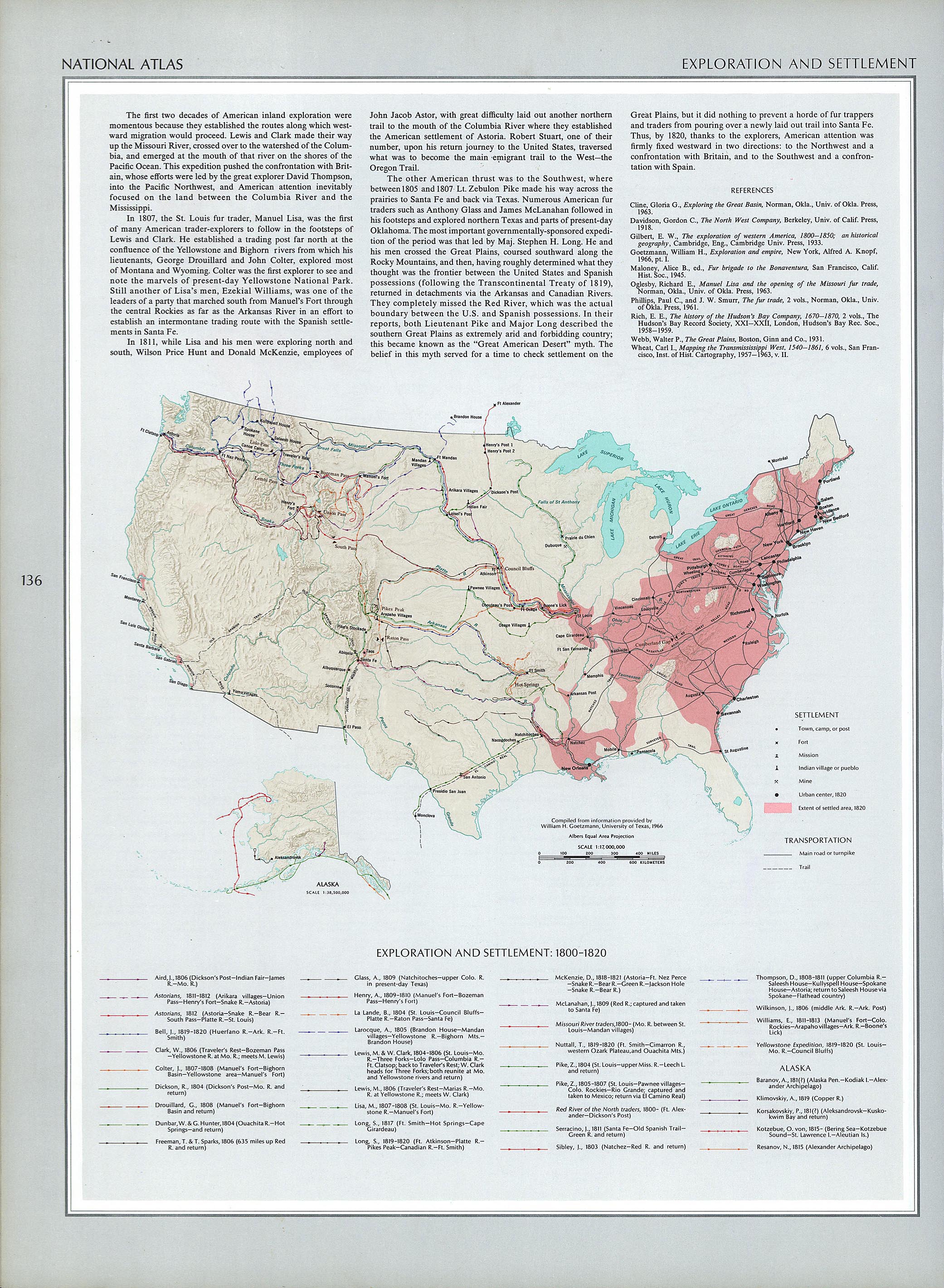
Exploration and Settlement (1800-1820)
(The National Atlas of the United States of America, 1970)
United States of America, 1804
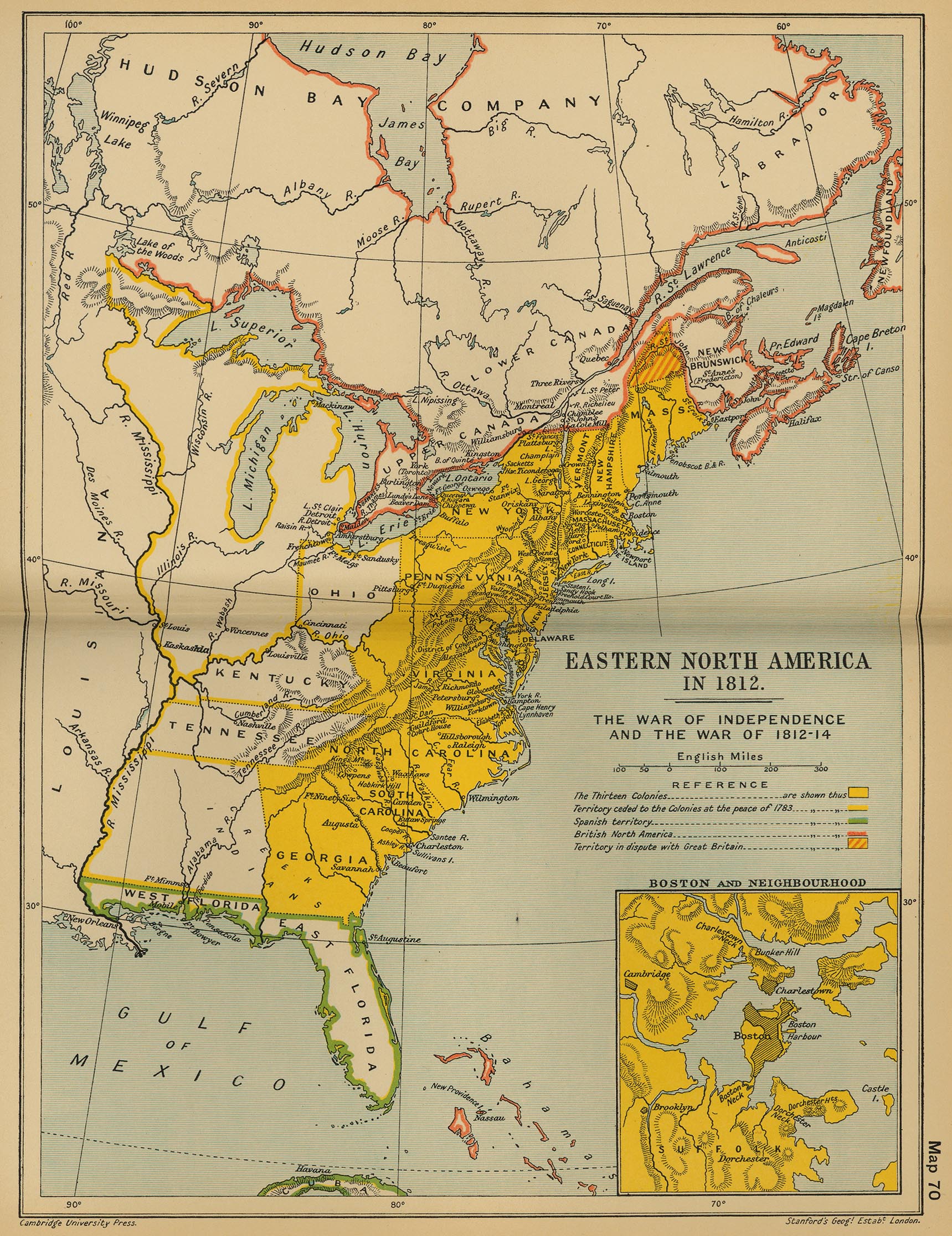
Eastern North America in 1812: The War of Independence and the War of 1812-1814
(Cambridge..., 1912)
The War of 1812
(McConnell’s Historical Maps of the United States, 1919)
A Map of the United States, 1814
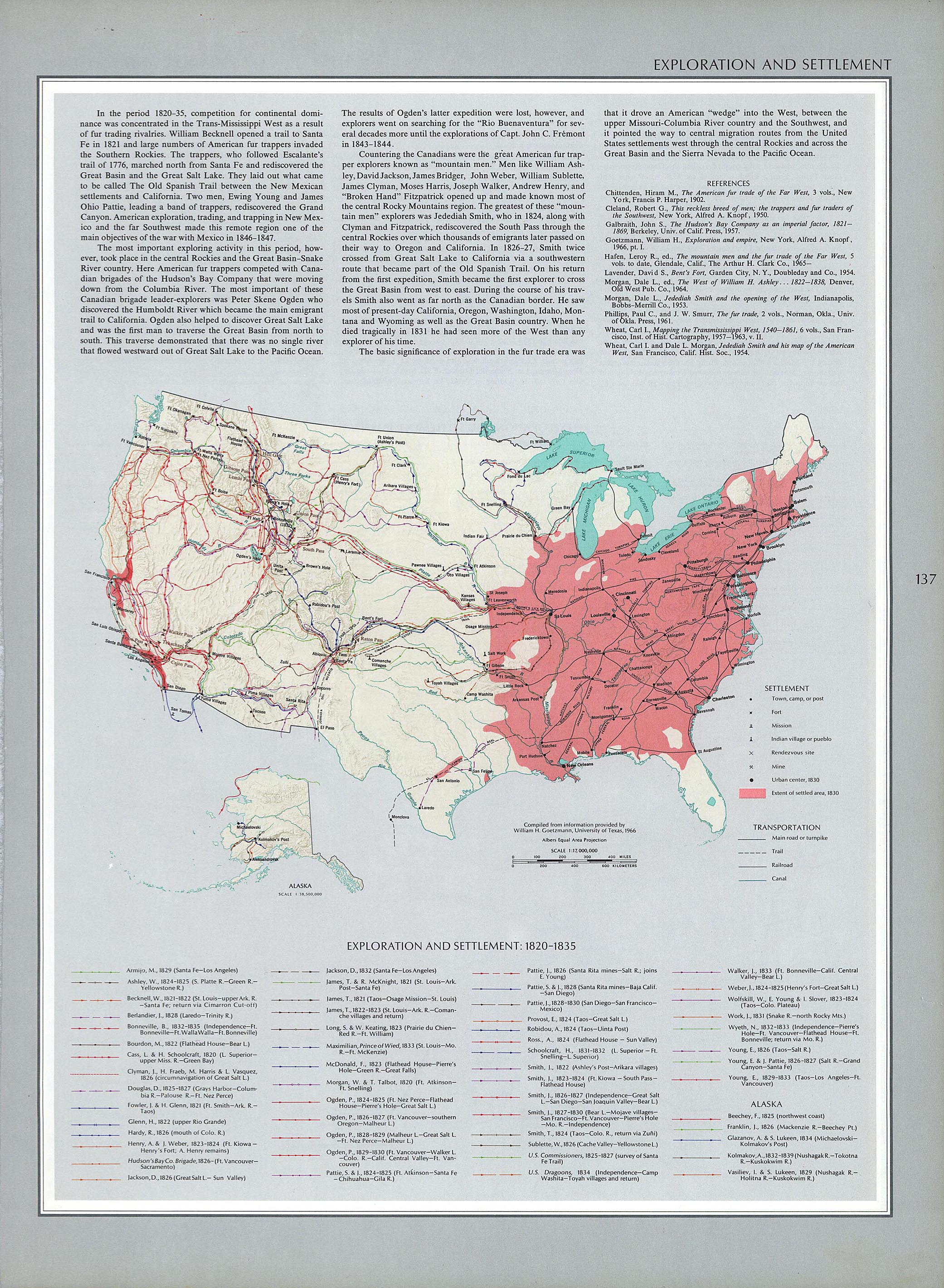
Exploration and Settlement (1820-1835)
(The National Atlas of the United States of America, 1970)
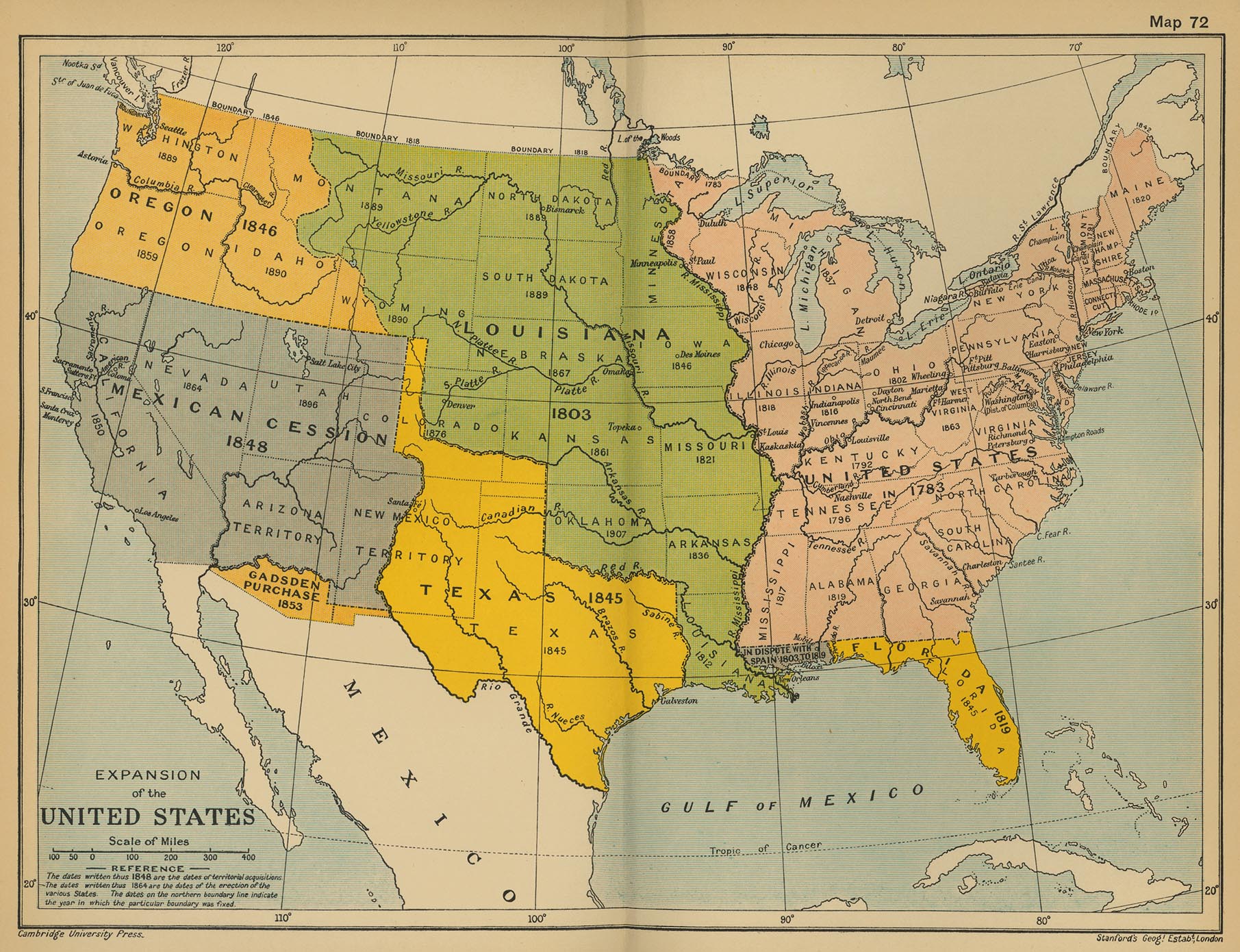
Expansion of the United States
(Cambridge Modern History Atlas, 1912)
Territorial Growth
(The National Atlas of the United States of America, 1970)
United States of America, 1820-1821
The Missouri Compromise, 1820-1821
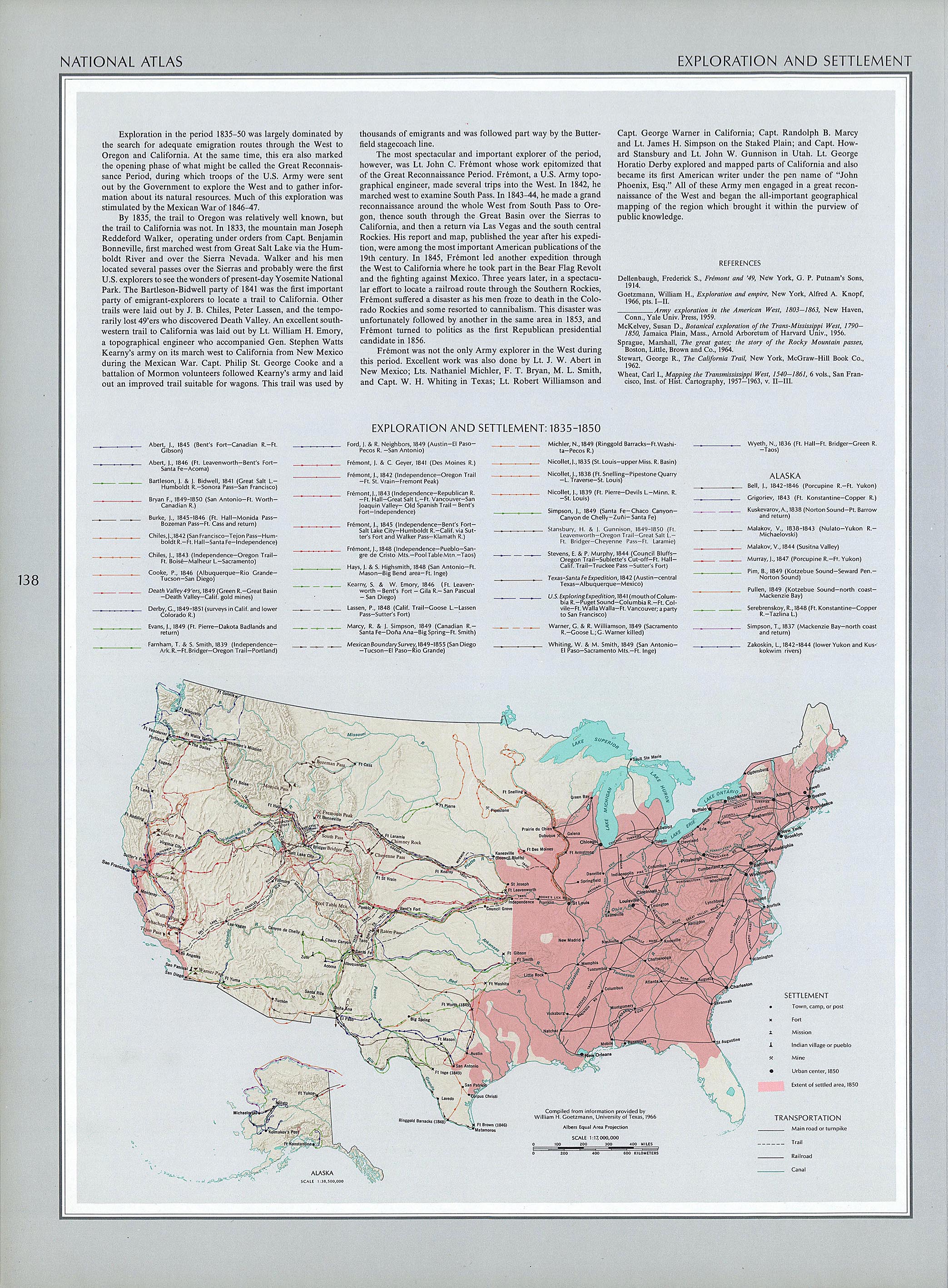
Exploration and Settlement (1835-1850)
(The National Atlas of the United States of America, 1970)
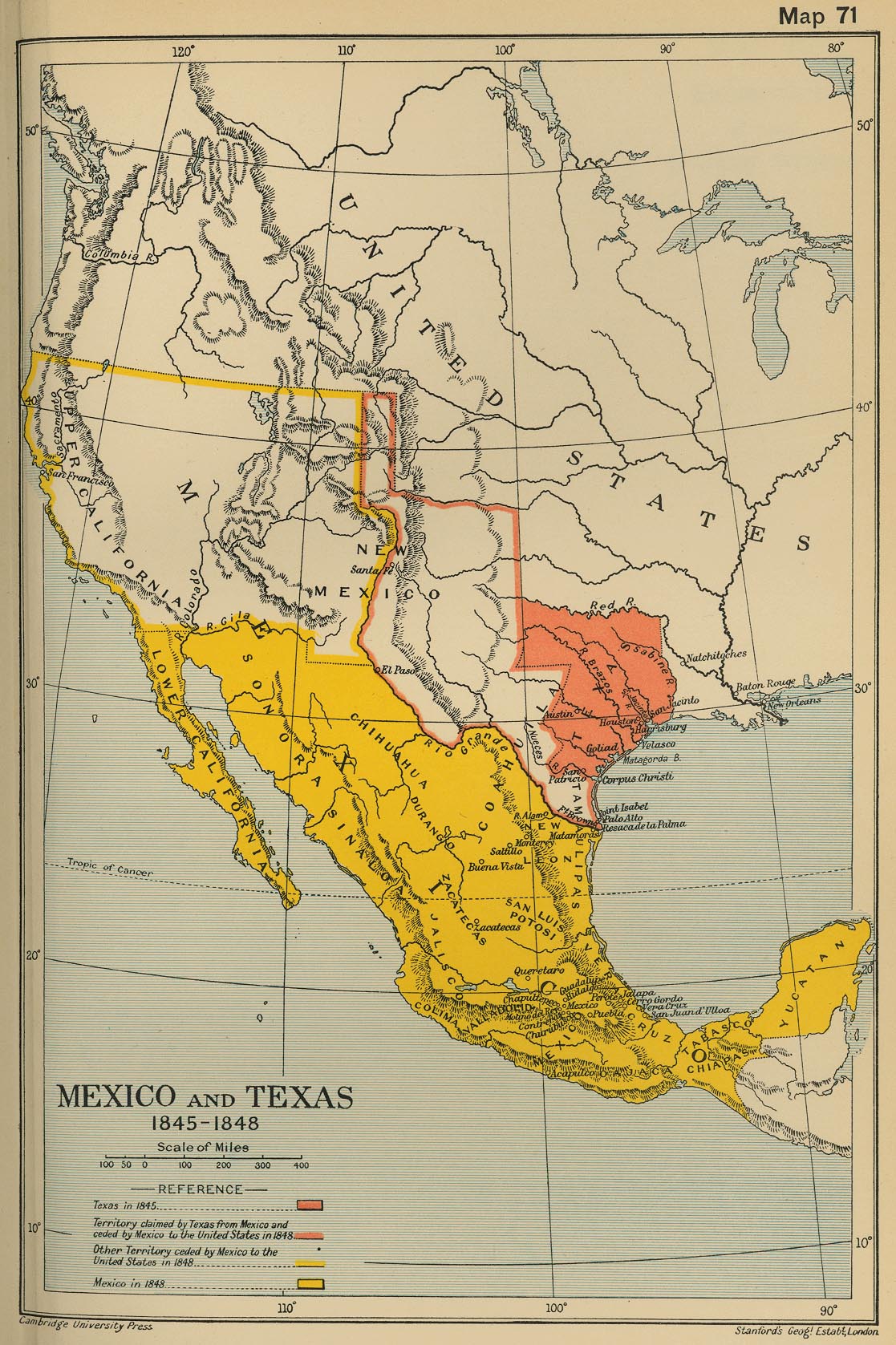
Mexico and Texas, 1845-1848
(Cambridge Modern History Atlas, 1912)
Oregon Treaty, 1846
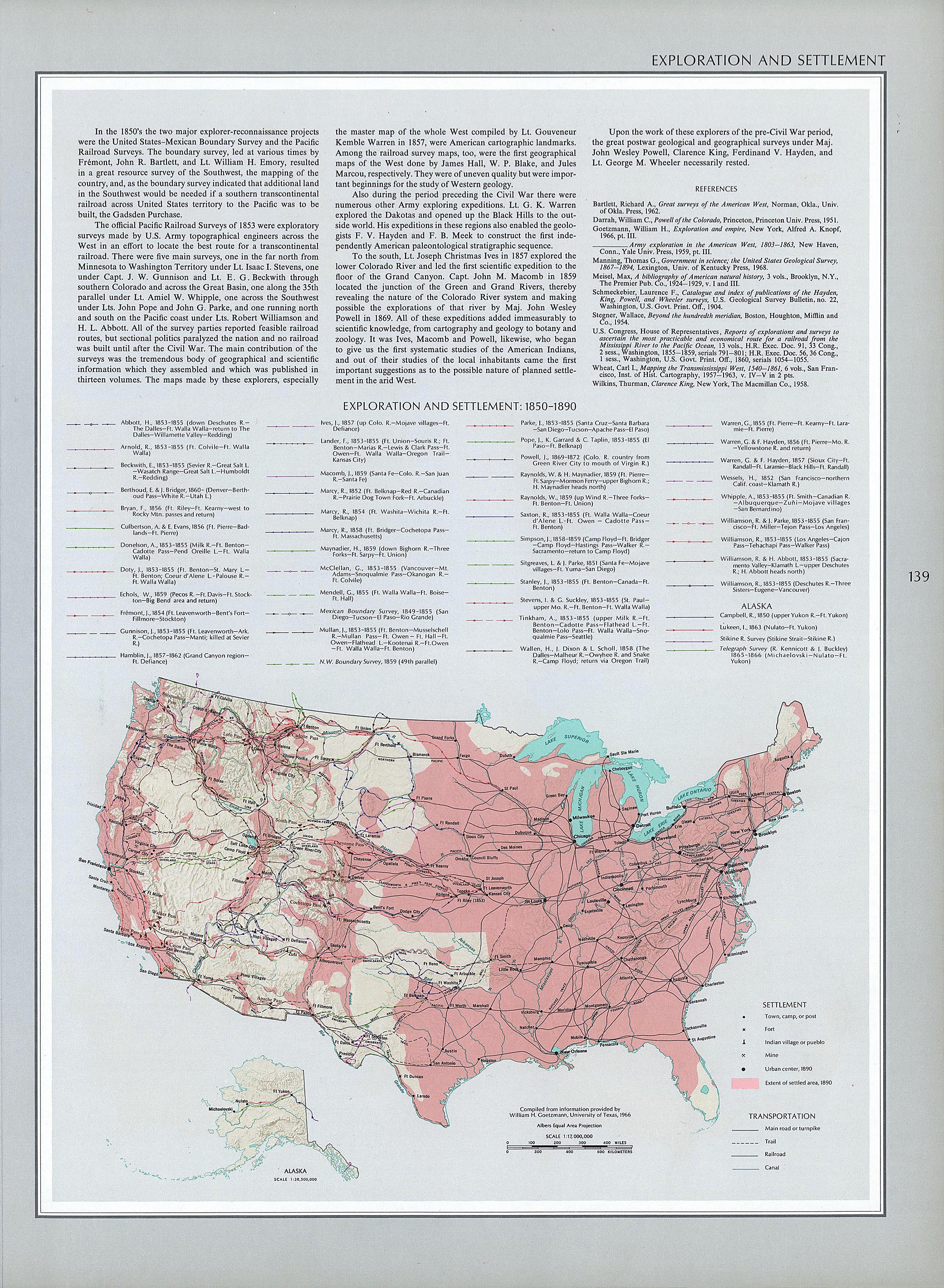
Exploration and Settlement (1850-1890)
(The National Atlas of the United States of America, 1970)
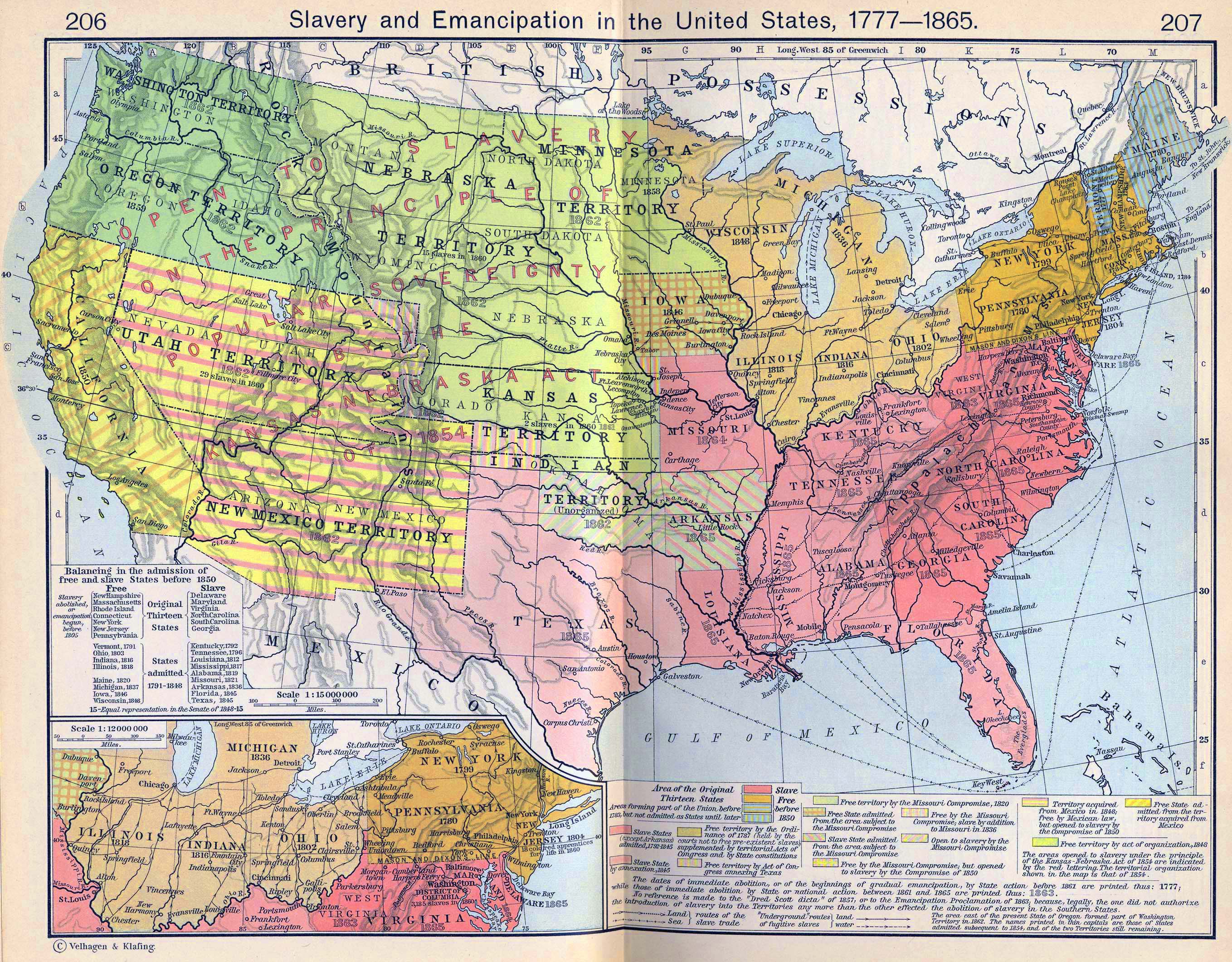
Slavery and Emancipation in the United States, 1777-1865
Reynolds’s Political Map of the United States... (cca. 1850)
The Compromise of 1850
(McConnell’s Historical Maps of the United States, 1919)
Kansas-Nebraska Act, 1854
(McConnell’s Historical Maps of the United States, 1919)
The United States: The Secession
(Cambridge Modern History Atlas, 1912)
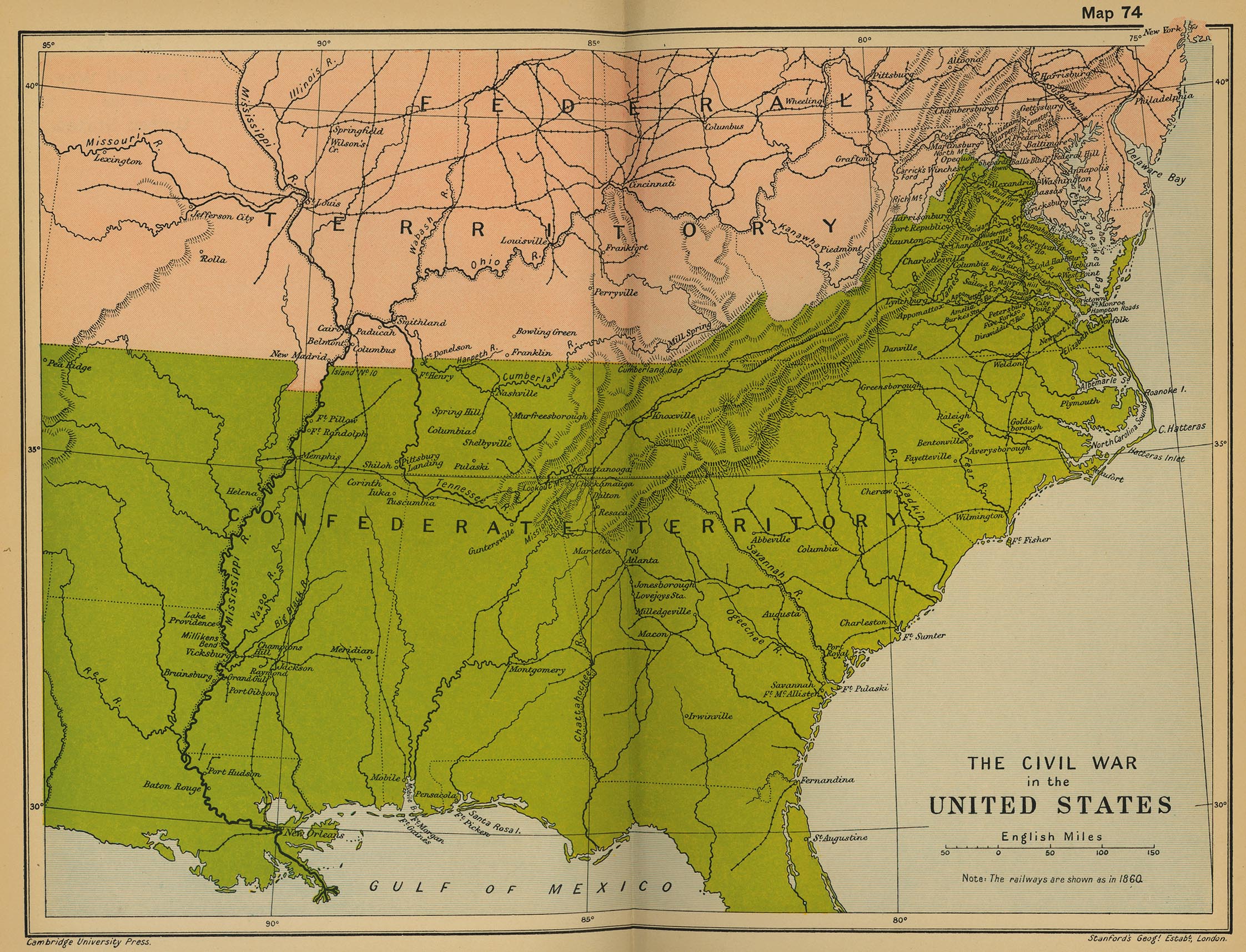
The Civil War in the United States
(Cambridge Modern History Atlas, 1912)
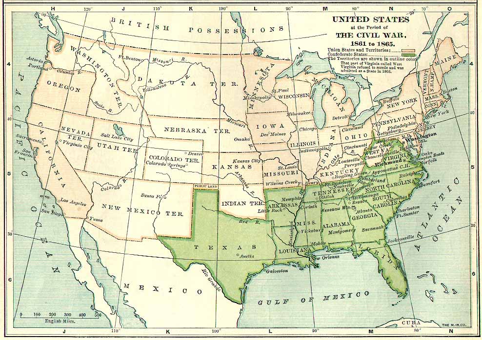
United States at the Period of the Civil War, 1861 to 1865
(The Century Atlas of the World, 1900)
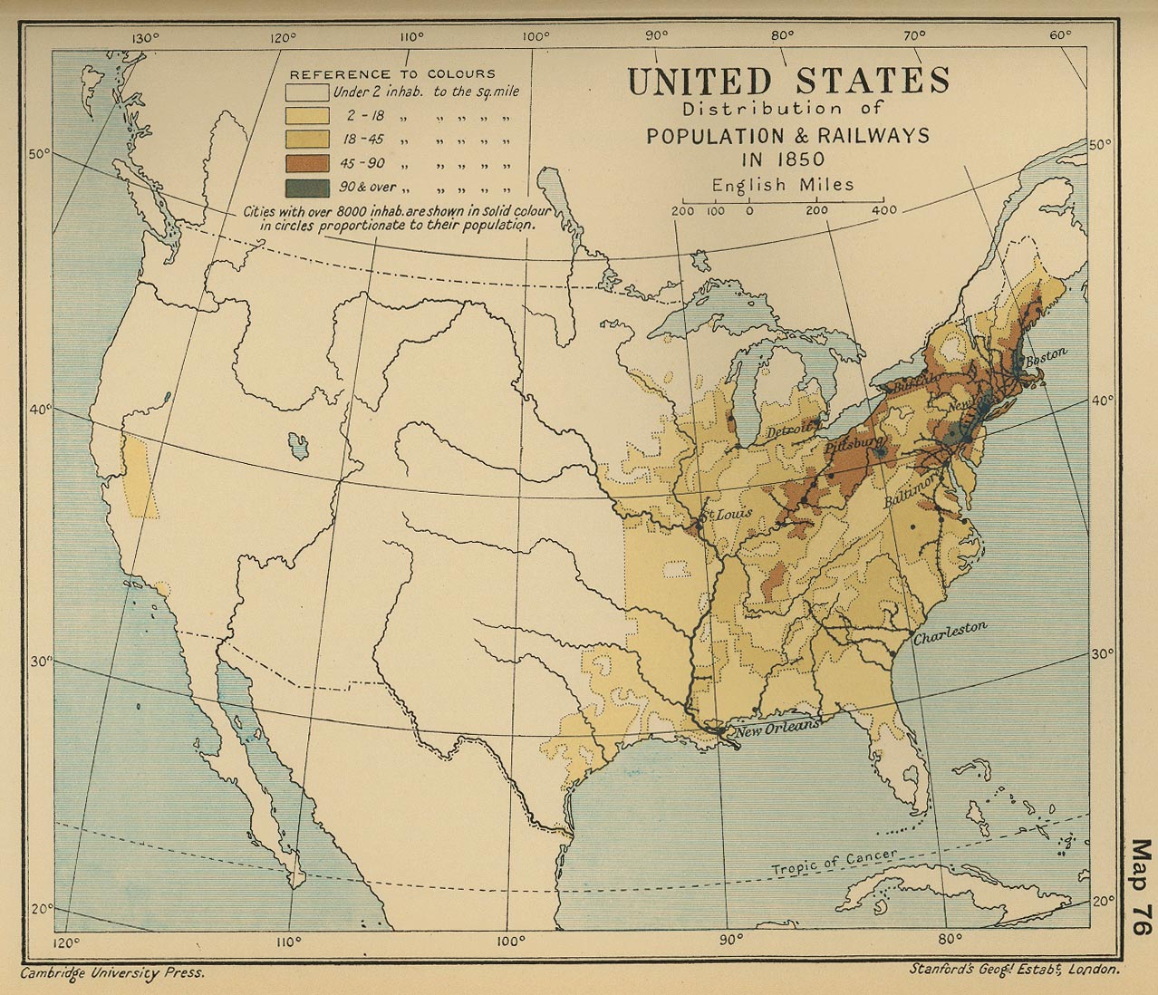
United States: Distribution of Population & Principal Railways in 1850
(Cambridge Modern History Atlas, 1912)
Unites States, 1872
(Atlas of New Jersey, 1872)
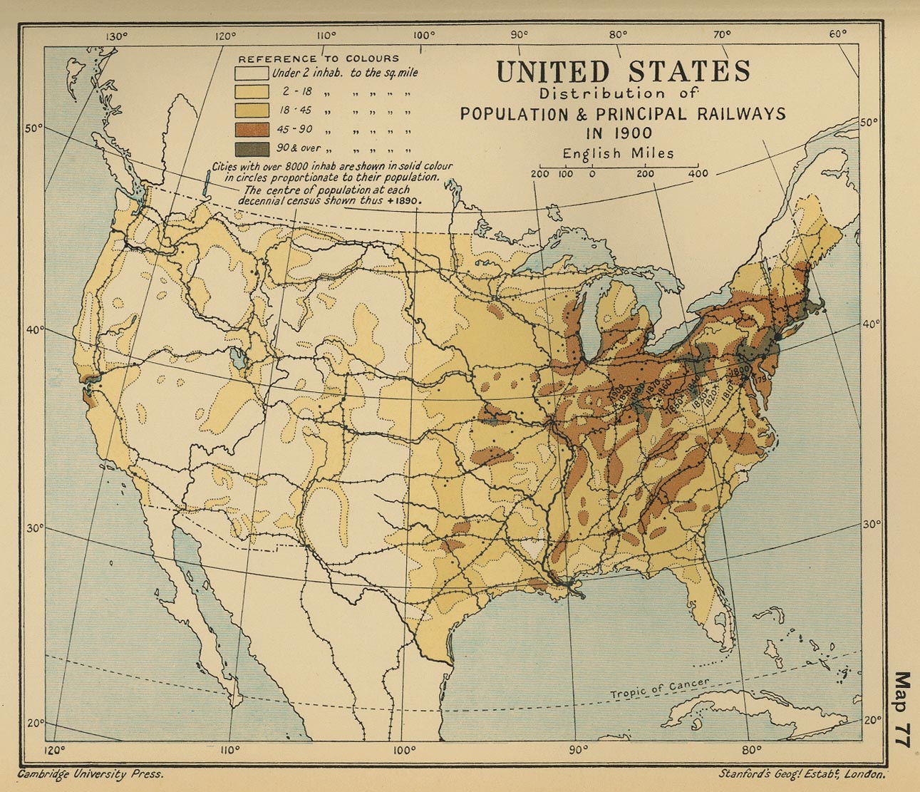
United States: Distribution of Population & Principal Railways in 1900
(Cambridge Modern History Atlas, 1912)
United States, 1923
(National Geographic)
United States, 1951
(George Philip & Son)
Maps of the 2012 US presidential elections results
(Mark Newman, University of Michigan)
Maps of the 2012 US presidential elections maps
(New York Times)
Maps of the 2012 US presidential elections maps
(Washington Post)
Maps of the 2012 US presidential elections maps
(Los Angeles Times)
Maps of the 2012 US presidential elections maps
(ABC)
Dave Leip’s Atlas of U.S. Presidential Elections
Language Most Commonly Spoken at Home, Other Than English or Spanish
2016 US Presidential Election Map by County & Vote Share
(brilliantmaps.com)
2016 Presidential Election Results
(www.politicon.com)
US election 2016: Trump victory in maps
(BBC)
US Election 2020: Results and exit poll in maps and charts
(BBC)

